MyTopo
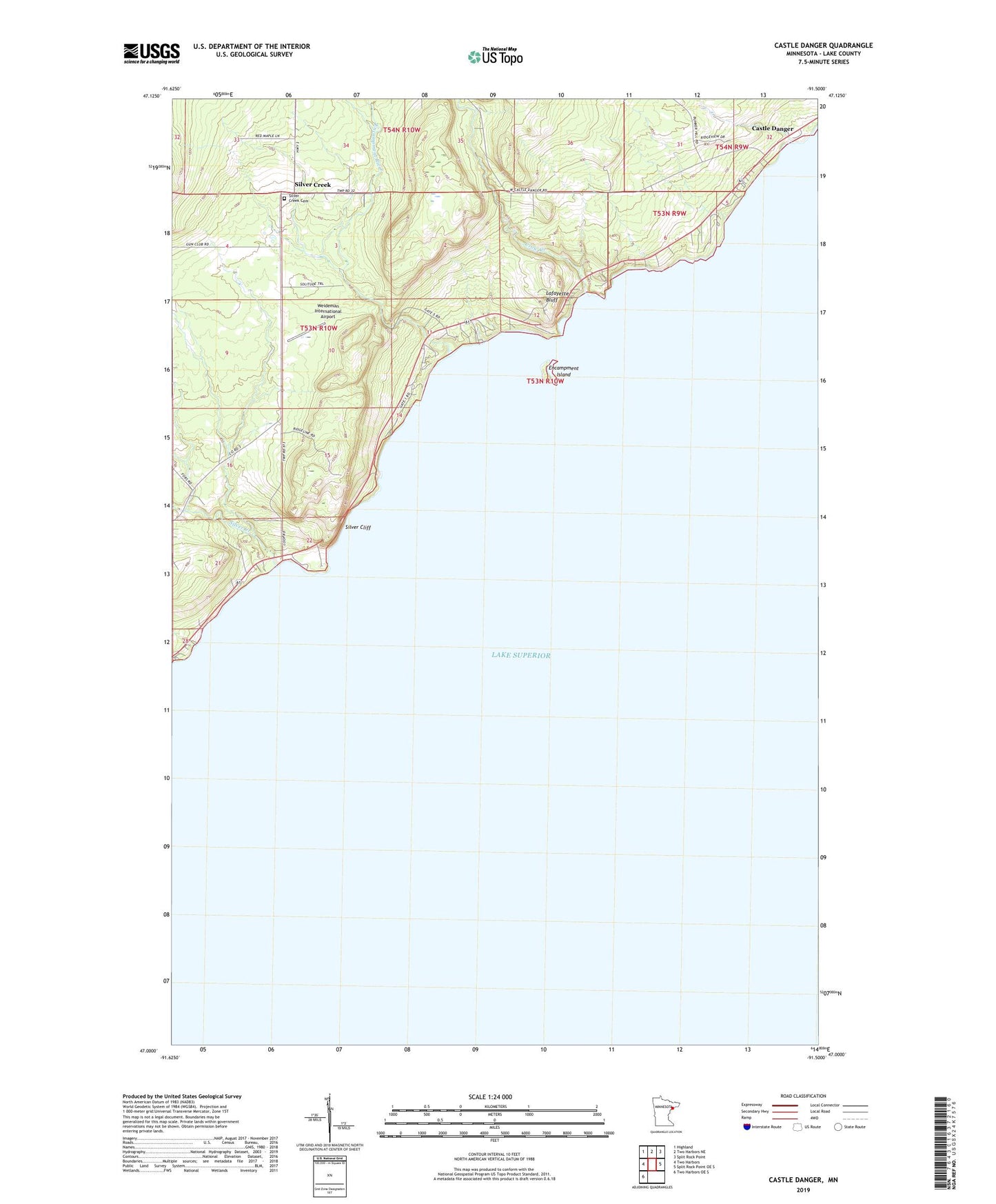
Castle Danger Minnesota US Topo Map
Couldn't load pickup availability
2019 topographic map quadrangle Castle Danger in the state of Minnesota. Scale: 1:24000. Based on the newly updated USGS 7.5' US Topo map series, this map is in the following counties: Lake. The map contains contour data, water features, and other items you are used to seeing on USGS maps, but also has updated roads and other features. This is the next generation of topographic maps. Printed on high-quality waterproof paper with UV fade-resistant inks.
Quads adjacent to this one:
West: Two Harbors
Northwest: Highland
North: Two Harbors NE
Northeast: Split Rock Point
East: Split Rock Point OE S
Southwest: Two Harbors OE S
Contains the following named places: Castle Danger, Crow Creek, Encampment Island, Encampment River, Lafayette Bluff, Our Saviours Church, Petes Creek, Silver Cliff, Silver Creek, Silver Creek Cemetery, Silver Creek Cliff Wayside Park, Silver Creek Community Church, Weideman International Airport