MyTopo
Cromwell West Minnesota US Topo Map
Couldn't load pickup availability
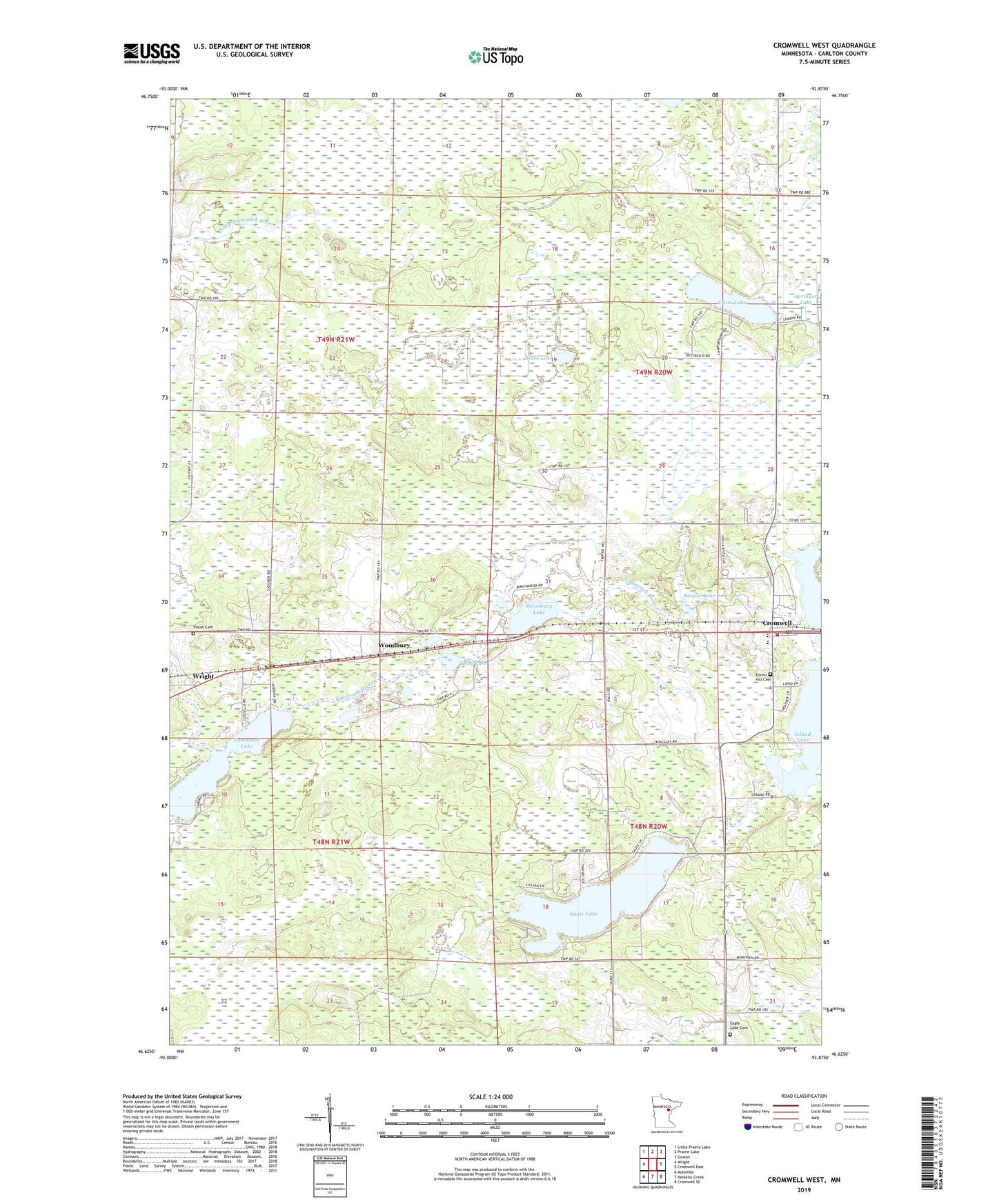
2019 topographic map quadrangle Cromwell West in the state of Minnesota. Scale: 1:24000. Based on the newly updated USGS 7.5' US Topo map series, this map is in the following counties: Carlton. The map contains contour data, water features, and other items you are used to seeing on USGS maps, but also has updated roads and other features. This is the next generation of topographic maps. Printed on high-quality waterproof paper with UV fade-resistant inks.
Quads adjacent to this one:
West: Wright
Northwest: Little Prairie Lake
North: Prairie Lake
Northeast: Gowan
East: Cromwell East
Southeast: Cromwell SE
South: Heikkila Creek
Southwest: Automba
Contains the following named places: Bethany Lutheran Church, Birch Bay Campground, Black Lake, Camp Lawrie, Cromwell, Cromwell Fire Department and Ambulance, Cromwell Post Office, Cromwell-Wright Public School, Cross Lake, Eagle Lake, Eagle Lake Cemetery, Flower Lake, Forest Hill Cemetery, Gateway Family Health Clinic, Immaculate Conception Church, Island Lake, Long Lake, Tamarack Lake, Township of Red Clover, Villa Vista Nursing Home, Violet Cemetery, Woodbury, Woodbury Lake, ZIP Code: 55798