MyTopo
Crystal Lake Minnesota US Topo Map
Couldn't load pickup availability
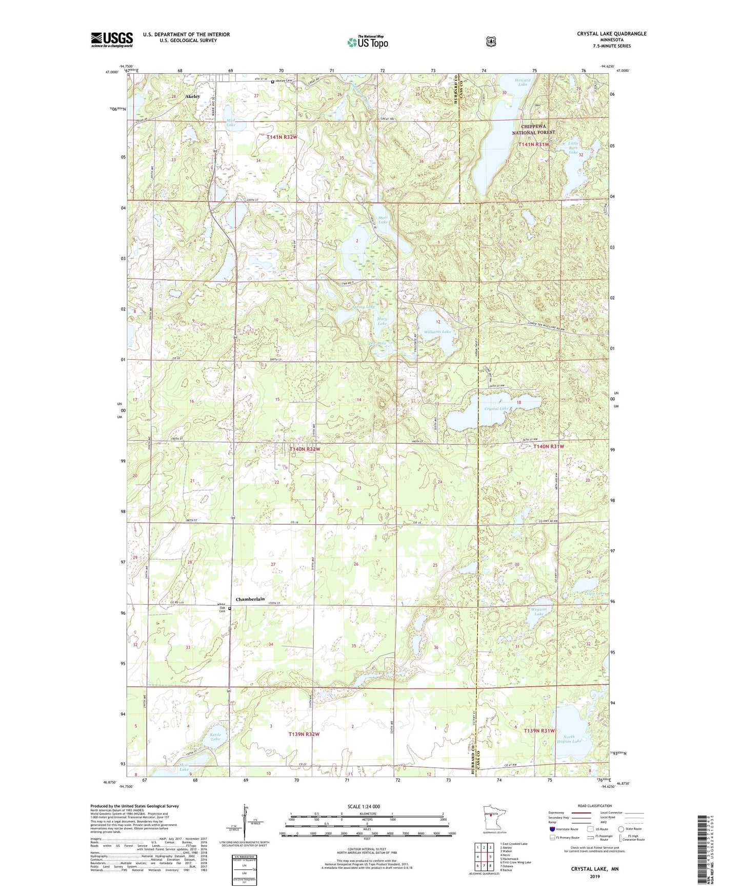
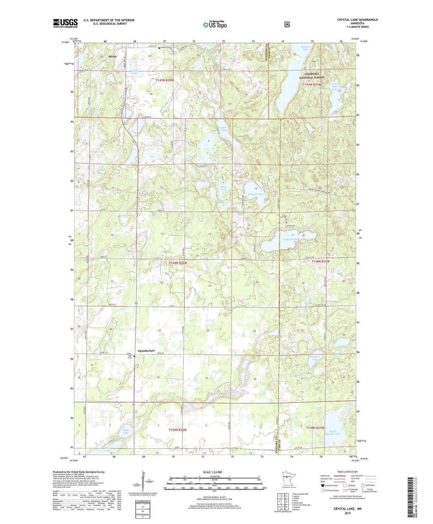
2019 topographic map quadrangle Crystal Lake in the state of Minnesota. Scale: 1:24000. Based on the newly updated USGS 7.5' US Topo map series, this map is in the following counties: Hubbard, Cass. The map contains contour data, water features, and other items you are used to seeing on USGS maps, but also has updated roads and other features. This is the next generation of topographic maps. Printed on high-quality waterproof paper with UV fade-resistant inks.
Quads adjacent to this one:
West: Nevis
Northwest: East Crooked Lake
North: Akeley
Northeast: Walker
East: Hackensack
Southeast: Backus
South: Oshawa
Southwest: First Crow Wing Lake
Contains the following named places: Akeley Cemetery, Chamberlain, Chamberlin Post Office, Crystal Lake, Doe Lake, Howard Lake, Island Lake, Kettle Lake, Little Bass Lake, Mary Lake, Moore Springs Resort Lodge and RV Park, Mud Lake, North Haynes Lake, Robinson Lake, Spring Lake, Steel Lake, Township of White Oak, Tripp Lake, Wegwos Lake, White Oak Baptist Church, White Oak Bible Chapel, White Oak Cemetery, Williams Lake, ZIP Code: 56433