MyTopo
Dorset Minnesota US Topo Map
Couldn't load pickup availability
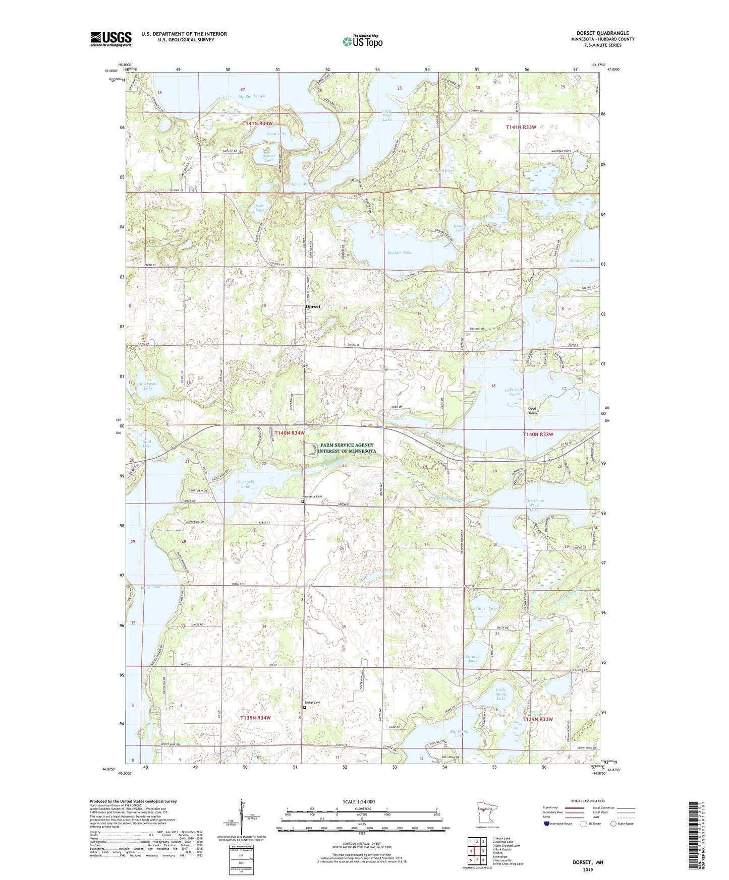
2019 topographic map quadrangle Dorset in the state of Minnesota. Scale: 1:24000. Based on the newly updated USGS 7.5' US Topo map series, this map is in the following counties: Hubbard. The map contains contour data, water features, and other items you are used to seeing on USGS maps, but also has updated roads and other features. This is the next generation of topographic maps. Printed on high-quality waterproof paper with UV fade-resistant inks.
Quads adjacent to this one:
West: Park Rapids
Northwest: Skunk Lake
North: Mantrap Lake
Northeast: East Crooked Lake
East: Nevis
Southeast: First Crow Wing Lake
South: Huntersville
Southwest: Menahga
Contains the following named places: Bear's Den Golf Course, Beaver Lake, Bethel Cemetery, Big Stony Lake, Boulder Lake, Clausens Lake, Crow Wing Number 5 Lake Dam, Deer Lake, Dorset, Dorset Lookout Tower, Dorset Post Office, Dorset Railroad Station, Evergreen Lodge Golf Course, Fifth Crow Wing Lake, First English Lutheran Church, Gartner Dairy, Goat Island, Hellkamp Creek, Henrietta Cemetery, Ida Lake, Lake Belle Taine, Little Sand Lake, Little Stony Lake, Long Lake, Loon Lake, Mud Lake, Park Rapids Pit, Peysenske Lake, Pine Manor, Rockwell Lake, Round Lake, Sand River, Shallow Lake, Shinker Lake, Stockade Campground, Sunday Lake, Township of Henrietta