MyTopo
Mantrap Lake Minnesota US Topo Map
Couldn't load pickup availability
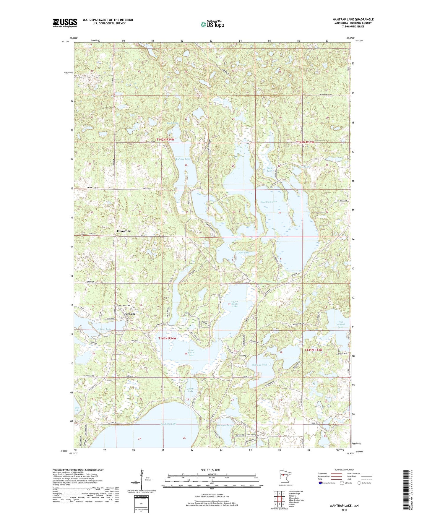
2022 topographic map quadrangle Mantrap Lake in the state of Minnesota. Scale: 1:24000. Based on the newly updated USGS 7.5' US Topo map series, this map is in the following counties: Hubbard. The map contains contour data, water features, and other items you are used to seeing on USGS maps, but also has updated roads and other features. This is the next generation of topographic maps. Printed on high-quality waterproof paper with UV fade-resistant inks.
Quads adjacent to this one:
West: Skunk Lake
Northwest: Schoolcraft Lake
North: Lake George
Northeast: Laporte
East: East Crooked Lake
Southeast: Nevis
South: Dorset
Southwest: Park Rapids
This map covers the same area as the classic USGS quad with code o47094a8.
Contains the following named places: Bad Axe Lake, Big Sand Lake, Buck Lake, Dead Horse Lake, Deer Lane, Emma Lake, Emmaville, Emmaville Post Office, Giles Lake, Gilmore Lake, Hubbard County, Jemstar Lake and Woods Campground, Lake Emma Cemetery, Lower Bottle Lake, Mantrap Lake, Mantrap Post Office, Mud Lake, Ojibway Lake, Oran Post Office, Petit Lake, Pickerel Lake, Sleeping Fawn Resort and Campground, Stocking Lake, Township of Clay, Township of Lake Emma, Upper Bottle Lake, West Crooked Lake