MyTopo
Dunnell Minnesota US Topo Map
Couldn't load pickup availability
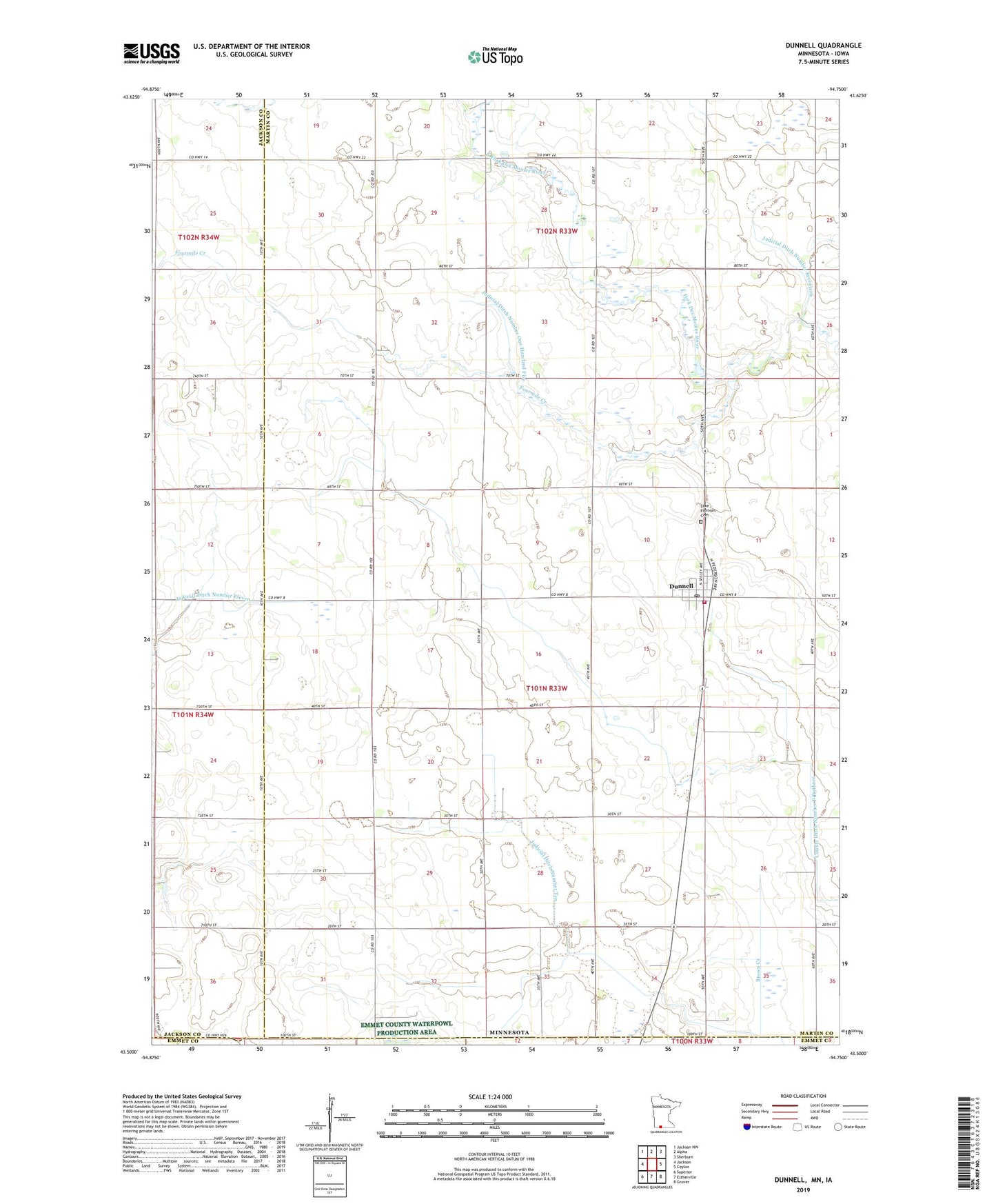
2019 topographic map quadrangle Dunnell in the state of Minnesota. Scale: 1:24000. Based on the newly updated USGS 7.5' US Topo map series, this map is in the following counties: Martin, Jackson, Emmet. The map contains contour data, water features, and other items you are used to seeing on USGS maps, but also has updated roads and other features. This is the next generation of topographic maps. Printed on high-quality waterproof paper with UV fade-resistant inks.
Quads adjacent to this one:
West: Jackson
Northwest: Jackson NW
North: Alpha
Northeast: Sherburn
East: Ceylon
Southeast: Gruver
South: Estherville
Southwest: Superior
Contains the following named places: City of Dunnell, County Ditch Number Fiftythree, Dunnell, Dunnell - Lake Fremont Fire Department, Dunnell Library, Dunnell Police Department, Dunnell Post Office, Dunnell Wayside, Fourmile Creek, Immanuel Lutheran Church, Judicial Ditch Number One Hundred Five, Judicial Ditch Number Seventeen, Judicial Ditch Number Ten, Lake Fremont Cemetery, Saint John's Lutheran Church, Township of Lake Fremont, ZIP Code: 56127