MyTopo
Estherville Iowa US Topo Map
Couldn't load pickup availability
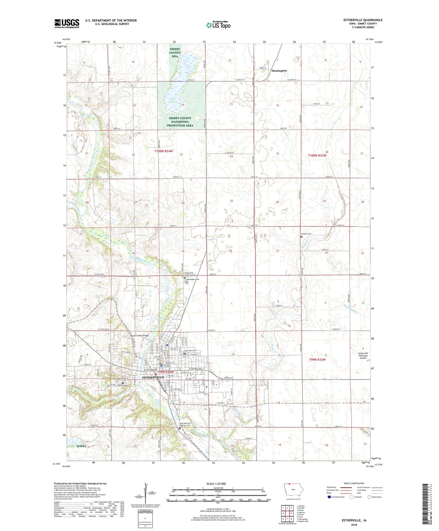
2022 topographic map quadrangle Estherville in the state of Iowa. Scale: 1:24000. Based on the newly updated USGS 7.5' US Topo map series, this map is in the following counties: Emmet. The map contains contour data, water features, and other items you are used to seeing on USGS maps, but also has updated roads and other features. This is the next generation of topographic maps. Printed on high-quality waterproof paper with UV fade-resistant inks.
Quads adjacent to this one:
West: Superior
Northwest: Jackson
North: Dunnell
Northeast: Ceylon
East: Gruver
Southeast: Ingham Lake
South: Wallingford
Southwest: Terril
This map covers the same area as the classic USGS quad with code o43094d7.
Contains the following named places: Anderson Prairie State Preserve, Avera Holy Family Hospital, Boe Farm, Bolstead School, Brown Creek, Calvary Baptist Church, Calvary Gospel Assembly, Church of Christ, Church of the Nazarene, City of Estherville, Ditch Number 121, Ditch Number 29, Eagle Lake, Eagle Lake Wildlife Management Area, East Side Cemetery, Emmet County Courthouse, Emmet County Historical Society Museum, Emmet County Sheriff's Office, Emmet Post Office, Estherville, Estherville Ambulance Service, Estherville Community Christian School, Estherville Fire Department, Estherville Golf and Country Club, Estherville Lincoln Central Demoney Elementary School, Estherville Lincoln Central High School, Estherville Lincoln Central Middle School, Estherville Lutheran Cemetery, Estherville Lutheran Church, Estherville Medical Clinic, Estherville Meteorite Historical Marker, Estherville Post Office, Estherville Public Library, Estherville Water Treatment Plant, First Christian Church, First Presbyterian Church, Fort Defiance, Fort Defiance and Monument Historical Marker, Fort Defiance State Park, Fourth Street Bridge, Freedom Field Ultralight Flightpark, Good Samaritan Nursing Home, Grace Episcopal Church, Grass Lake, Grass Lake State Game Management Area, Huntington, Huntington Post Office, Immanuel Lutheran Church, Iowa Lakes Community College - Estherville Campus, Iowa Lakes Community College Library, Jackson School Post Office, Joe Hoye Park, KILR-AM (Estherville), KILR-FM (Estherville), Laker High School, Lakeside Post Office, Lincoln Elementary School, Madison Farms, McKinley Elementary School, McKinley School, Mike Mickelson Park, North Fourteenth Street Park, Northwest Iowa Podiatry Associates Center, Northwest Iowa Urologists Center, Norwegian Cemetery, Oak Hill Cemetery, Presbyterian Church, Prosser Cemetery, Redeemer Lutheran Church, Ringham Habitat Area, River Oaks Farm, Riverside Hills Ski Area, Riverside Park, Roosevelt Elementary School, Rosewood Manor Nursing Home, Saint Patrick's Catholic Cemetery, Saint Patricks Catholic Church, Saint Patricks Church, School Creek, South Fourteenth Street Park, South Tenth Street Park, Thoreson Memorial Park, Township of Emmet, Township of Estherville, Trinity Lutheran Church, Union Baptist Church, United Methodist Church, White Family Farms, White Farms, ZIP Code: 51334