MyTopo
Elmer Minnesota US Topo Map
Couldn't load pickup availability
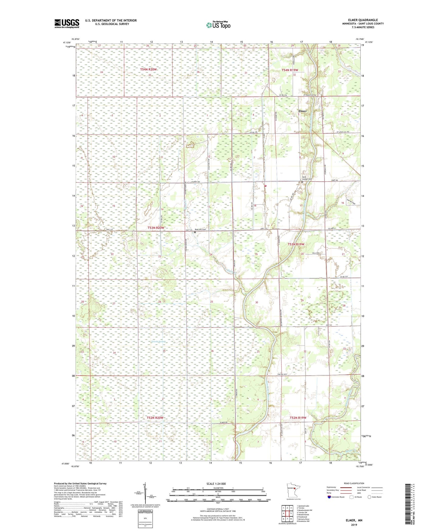
2019 topographic map quadrangle Elmer in the state of Minnesota. Scale: 1:24000. Based on the newly updated USGS 7.5' US Topo map series, this map is in the following counties: St. Louis. The map contains contour data, water features, and other items you are used to seeing on USGS maps, but also has updated roads and other features. This is the next generation of topographic maps. Printed on high-quality waterproof paper with UV fade-resistant inks.
Quads adjacent to this one:
West: Toivola SW
Northwest: Upstead Lake
North: Toivola
Northeast: Meadowlands NW
East: Meadowlands
Southeast: Brookston NW
South: McCarty River
Southwest: Floodwood
Contains the following named places: Elmer, Elmer Post Office, Elmer Station, Elmer Volunteer Fire Department, Rose Hill Cemetery, Saint Joseph Church, Saint Joseph's Cemetery, Skunk Creek, Spider Creek, Toivola Swamp, Township of Elmer, ZIP Code: 55765