
MyTopo
Finland Minnesota US Topo Map
Couldn't load pickup availability
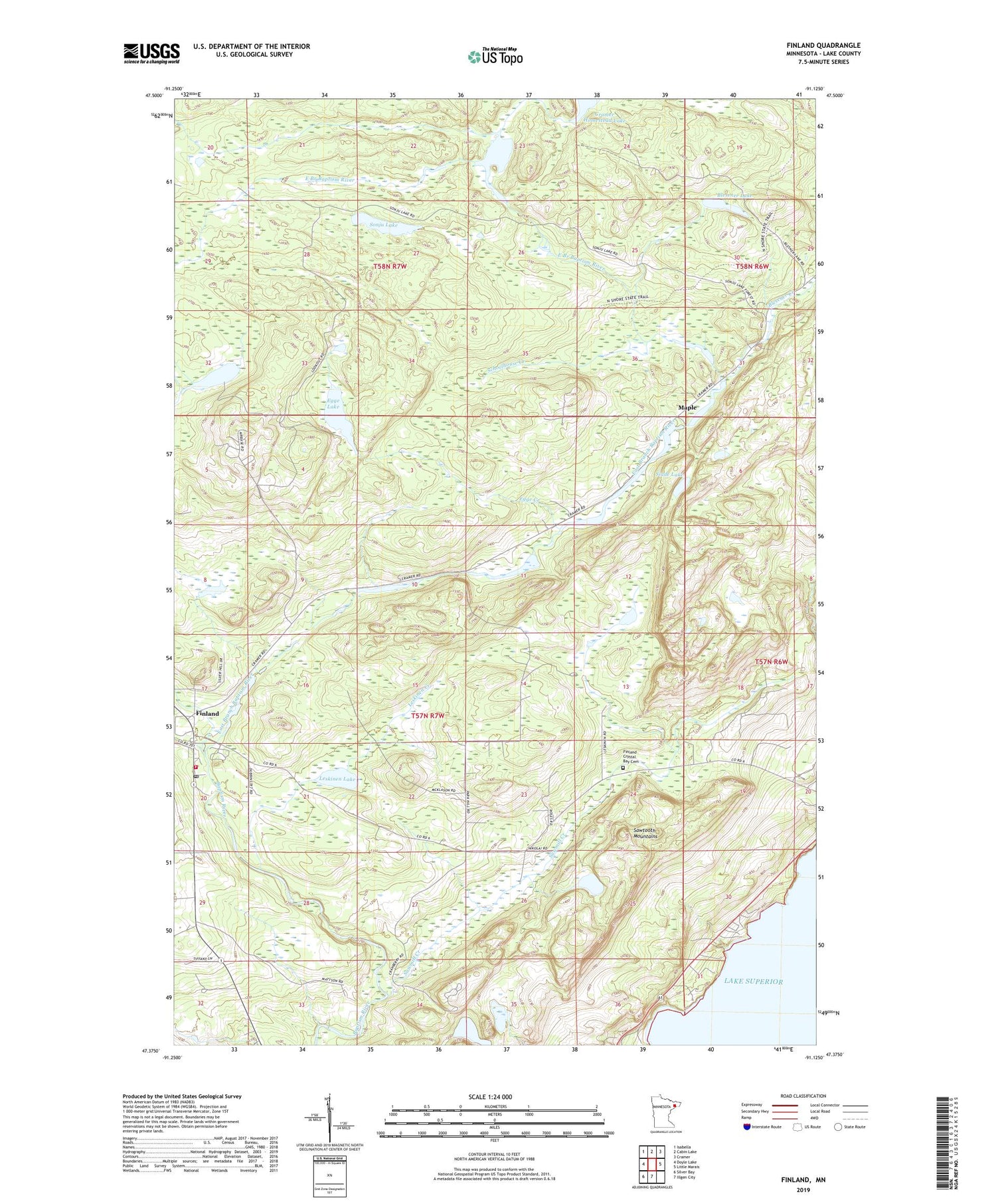
2019 topographic map quadrangle Finland in the state of Minnesota. Scale: 1:24000. Based on the newly updated USGS 7.5' US Topo map series, this map is in the following counties: Lake. The map contains contour data, water features, and other items you are used to seeing on USGS maps, but also has updated roads and other features. This is the next generation of topographic maps. Printed on high-quality waterproof paper with UV fade-resistant inks.
Quads adjacent to this one:
West: Doyle Lake
Northwest: Isabella
North: Cabin Lake
Northeast: Cramer
East: Little Marais
South: Illgen City
Southwest: Silver Bay
Contains the following named places: Bell Harbor, Blesener Creek, Blesener Lake, Cramer Homestead Lake, East Branch Baptism River, Egge Creek, Egge Lake, Finland, Finland Air Force Station, Finland Crystal Bay Cemetery, Finland Lookout Tower, Finland Post Office, Finland State Forest, Finland Volunteer Fire Department, Johnson Lake, Kennedy Landing, Lake Twentythree, Leskinen Creek, Leskinen Lake, Little Marais Postoffice, Lookout Lake, Maple, Sawmill Creek, Schoolhouse Creek, Slade Lake, Sonju Lake, West Branch Baptism River


