MyTopo
Finlayson Minnesota US Topo Map
Couldn't load pickup availability
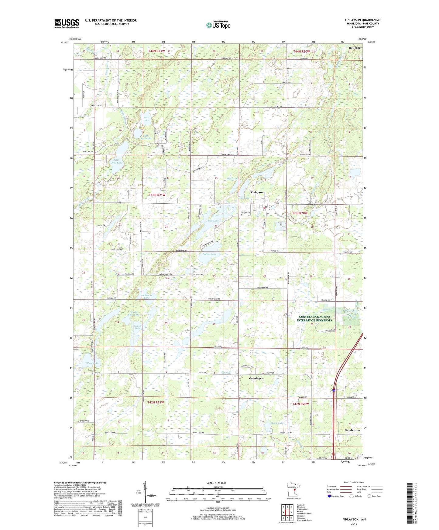
2019 topographic map quadrangle Finlayson in the state of Minnesota. Scale: 1:24000. Based on the newly updated USGS 7.5' US Topo map series, this map is in the following counties: Pine. The map contains contour data, water features, and other items you are used to seeing on USGS maps, but also has updated roads and other features. This is the next generation of topographic maps. Printed on high-quality waterproof paper with UV fade-resistant inks.
Quads adjacent to this one:
West: Giese
Northwest: Arthyde
North: Denham
Northeast: Willow River
East: Sandstone North
Southeast: Sandstone South
South: Hinckley
Southwest: Kroschel
Contains the following named places: Bass Lake, Charlie Bear Lake, City of Finlayson, Clear Lake, Elbow Lake, Finlayson, Finlayson City Hall, Finlayson Elementary School, Finlayson Fire Department, Finlayson Post Office, Finlayson United Methodist Church, Finnish Lutheran Cemetery, Fish Lake, Grass Lake, Groningen, Hellmans Lake, Immanuel Lutheran Church, Indian Lake, Koivisto School, Little Bass Lake, Little Pine Creek, Little Pine Lake, Medicine Creek, Miller Lake, Mud Lake, Peace Lutheran Church, Rhine Creek, Saint Johns Church, Skunk Lake, Township of Pine Lake