MyTopo
First Crow Wing Lake Minnesota US Topo Map
Couldn't load pickup availability
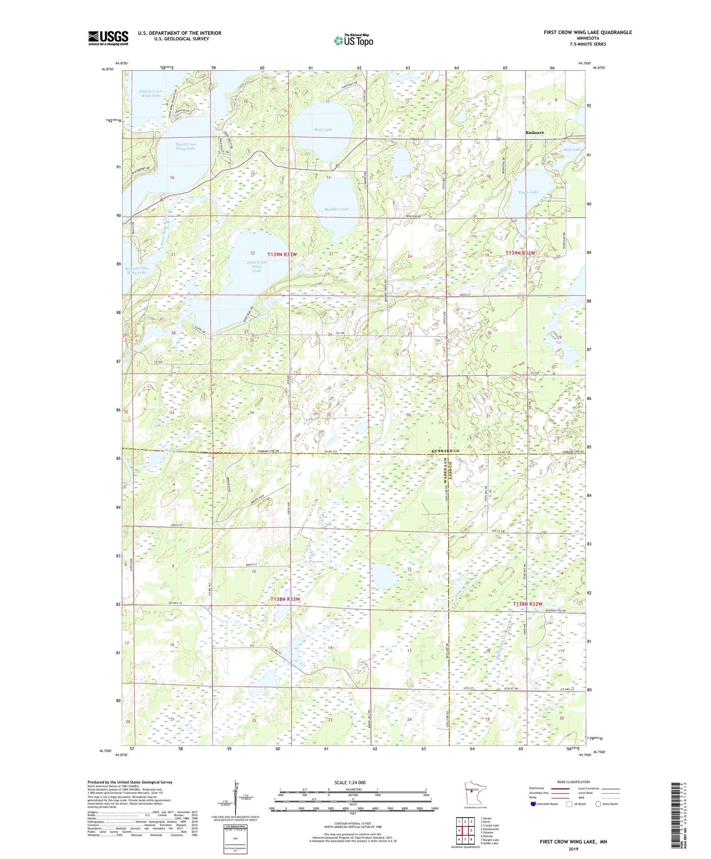
2019 topographic map quadrangle First Crow Wing Lake in the state of Minnesota. Scale: 1:24000. Based on the newly updated USGS 7.5' US Topo map series, this map is in the following counties: Hubbard, Wadena, Cass. The map contains contour data, water features, and other items you are used to seeing on USGS maps, but also has updated roads and other features. This is the next generation of topographic maps. Printed on high-quality waterproof paper with UV fade-resistant inks.
Quads adjacent to this one:
West: Huntersville
Northwest: Dorset
North: Nevis
Northeast: Crystal Lake
East: Oshawa
Southeast: Spider Lake
South: Burgen Lake
Southwest: Nimrod
Contains the following named places: Badoura, Badoura Post Office, Badoura Railroad Station, Bender Creek, Bigswamp Post Office, Bladder Lake, First Crow Wing Lake, Fourth Crow Wing Lake, Huntersville Field, Huntersville Impoundment Munber 3 Dam, Huntersville Impoundment Number 4 Dam, Mud Lake, Second Crow Wing Lake, Third Crow Wing Lake, Township of Crow Wing Lake, Township of Huntersville, Tripp Lake, Washburn Lake, Washburn Lake Dam, Wolf Lake