MyTopo
Spider Lake Minnesota US Topo Map
Couldn't load pickup availability
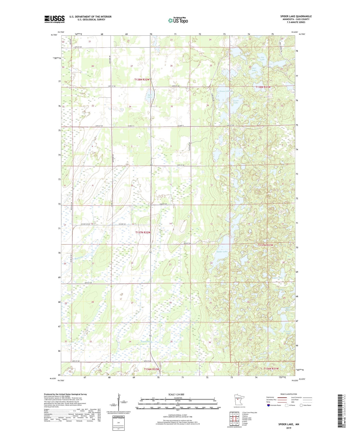
2022 topographic map quadrangle Spider Lake in the state of Minnesota. Scale: 1:24000. Based on the newly updated USGS 7.5' US Topo map series, this map is in the following counties: Cass. The map contains contour data, water features, and other items you are used to seeing on USGS maps, but also has updated roads and other features. This is the next generation of topographic maps. Printed on high-quality waterproof paper with UV fade-resistant inks.
Quads adjacent to this one:
West: Burgen Lake
Northwest: First Crow Wing Lake
North: Oshawa
Northeast: Backus
East: Bungo Creek
Southeast: Graff
South: Leader
Southwest: Oylen
This map covers the same area as the classic USGS quad with code o46094f6.
Contains the following named places: Bethlehem Church, Black Bear Golf Course, Clear Lake, Crane Lake, Cut Lake, Deer Lake, Foot Hills State Forest, Goose Lake, Green Lake, Mink Lake, Spider Lake, Spider Lake Lookout Tower, Spot Lake, Taylor Lake, Township of Ansel