MyTopo
Frazee Minnesota US Topo Map
Couldn't load pickup availability
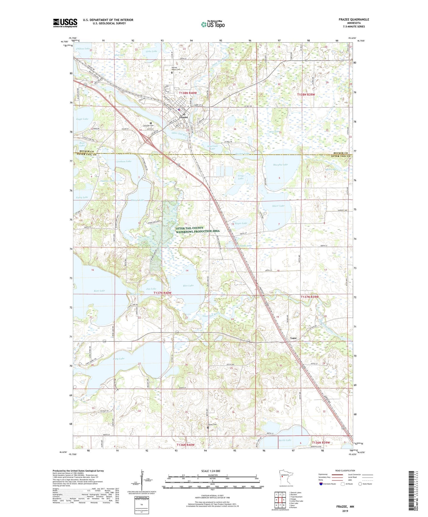
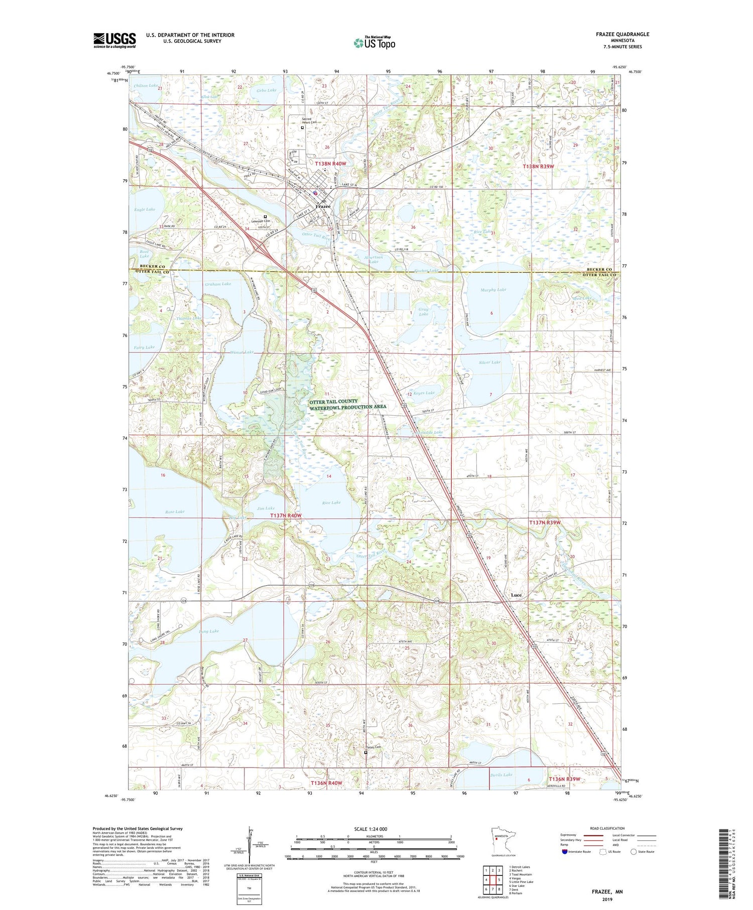
2019 topographic map quadrangle Frazee in the state of Minnesota. Scale: 1:24000. Based on the newly updated USGS 7.5' US Topo map series, this map is in the following counties: Otter Tail, Becker. The map contains contour data, water features, and other items you are used to seeing on USGS maps, but also has updated roads and other features. This is the next generation of topographic maps. Printed on high-quality waterproof paper with UV fade-resistant inks.
Quads adjacent to this one:
West: Vergas
Northwest: Detroit Lakes
North: Rochert
Northeast: Toad Mountain
East: Little Pine Lake
Southeast: Perham
South: Dent
Southwest: Star Lake
Contains the following named places: Acorn Lake, Acorn Lake Dam, Acorn Lake Mobile Home Court, Albertson Lake, Albertsons Lake Trailer Park, Bethlehem Lutheran Church, Boot Lake, Brink Lake, City of Frazee, Community of Christ Church, Dakota Clinic Ltd, Devils Lake, Fairy Lake, Feldt Mobile Home Park, Fischer Lake, Flatau Cemetery, Frazee, Frazee Care Center, Frazee Elementary School, Frazee Fire Department, Frazee Golf Course, Frazee Police Department, Frazee Post Office, Frazee Rest Area, Frazee Senior High School, Frazee Station, Gebo Lake, Gertrude Lake, Graham Lake, Gray Lake, Harvest Fellowship Church, Hobart Post Office, Jim Lake, Keyes Lake, Lakeside Cemetery, Long Lake, Long Lake Dam, Luce, Luce Post Office, Mud Lake, Murphy Lake, Pug Lake, Rice Lake, Rose Lake, Rose Lake Dam, Sacred Heart Cemetery, Sacred Heart Church, Silver Lake, Thomas Lake, Town Lake, Town Lake Dam, Town Lake Estates, Township of Hobart, Treasured Bay Resort and Campground, United Methodist Church, Wimar Lake, Wimer Lake, Wimer Lake Dam