MyTopo
Vergas Minnesota US Topo Map
Couldn't load pickup availability
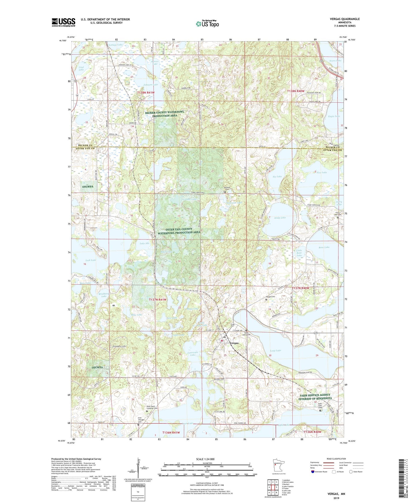
2022 topographic map quadrangle Vergas in the state of Minnesota. Scale: 1:24000. Based on the newly updated USGS 7.5' US Topo map series, this map is in the following counties: Otter Tail, Becker. The map contains contour data, water features, and other items you are used to seeing on USGS maps, but also has updated roads and other features. This is the next generation of topographic maps. Printed on high-quality waterproof paper with UV fade-resistant inks.
Quads adjacent to this one:
West: Lake Franklin
Northwest: Audubon
North: Detroit Lakes
Northeast: Rochert
East: Frazee
Southeast: Dent
South: Star Lake
Southwest: Lake Lida
This map covers the same area as the classic USGS quad with code o46095f7.
Contains the following named places: Acorn Lake, Baker Lake, Bass Lake, Bradbury Lake, Bradbury Post Office, Candor - Dora - Hobart - Vergas Fire and Rescue Department, Candor Lake, City of Vergas, Coffee Lake, Cottage Lake, Cozy Corner Campground, Dahring Dairy, Eagle Lake, Elbow Lake, Fairy Lake Cemetery, Five Lake, Free Thought Cemetery, Gresham Post Office, Happ Lake, Heisler's Country Camping, Horseshoe Lake, Johnson Lake, Lake Ida, Lake Sybil Post Office, Lakes Area Word Fellowship, Lawrence Lake, Leek Lake, Lind Lake, Little Long Lake, Little Rose Lake, Long Lake, Long Lake - Vergas Rest Area, Loon Lake, Loon Lake Lutheran Church, Loon Lake Resort and Campground, Mike Lake, Nottage Lake, Pete Lake, Reeves Lake, Rose Shores Campground, Saint Johns Cemetery, Saint John's Lutheran Church, Saint Pauls Church, Saint Paul's Lutheran Cemetery, Scalp Lake, Schrams Cemetery, Schrams Lake, Six Lake, Sybil Lake, Sybil Lake Cemetery, Township of Candor, Trowbridge Lake, United Methodist Church, Vergas, Vergas City Cemetery, Vergas Park, Vergas Post Office, ZIP Code: 56587