
MyTopo
Gatzke SW Minnesota US Topo Map
Couldn't load pickup availability
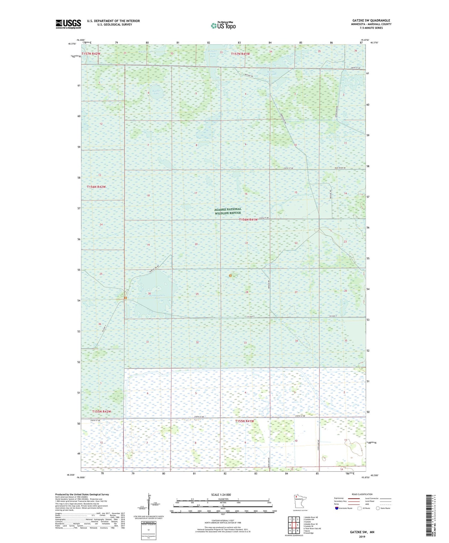
2019 topographic map quadrangle Gatzke SW in the state of Minnesota. Scale: 1:24000. Based on the newly updated USGS 7.5' US Topo map series, this map is in the following counties: Marshall. The map contains contour data, water features, and other items you are used to seeing on USGS maps, but also has updated roads and other features. This is the next generation of topographic maps. Printed on high-quality waterproof paper with UV fade-resistant inks.
Quads adjacent to this one:
West: Middle River SE
Northwest: Middle River NE
North: Gatzke NW
Northeast: Gatzke
East: Gatzke SE
Southeast: Goodridge
South: Mavie
Southwest: Thief River Falls NE
Contains the following named places: Agassiz National Wildlife Refuge, Agassiz Wilderness, Dahl Pool, East Pool, Elm Lake Wildlife Management Area, Headquarters Pool, Judicial Ditch Number Eleven, Kelly Pool, Kuriko Lake, Lost Bay, Lost Bay Pool, Lost River, Lower CCC Pool, Middle CCC Pool, Mud River Pool, Pool Eighteen Dam, Pool Fifteen Dam, Pool Fourteen Dam, Pool Nineteen Dam, Pool Seven Dam, Pool Seventeen Dam, Pool Twenty Dam, Pool Twenty One Dam, Pool Twenty Two Dam, Pool Twentyfive Dam, Pool Twentyfour Dam, Pool Twentythree Dam, South Pool, Unorganized Territory of Mud Lake, Upper CCC Pool, Webster Creek Pool, Whisky Lake


