MyTopo
Mavie Minnesota US Topo Map
Couldn't load pickup availability
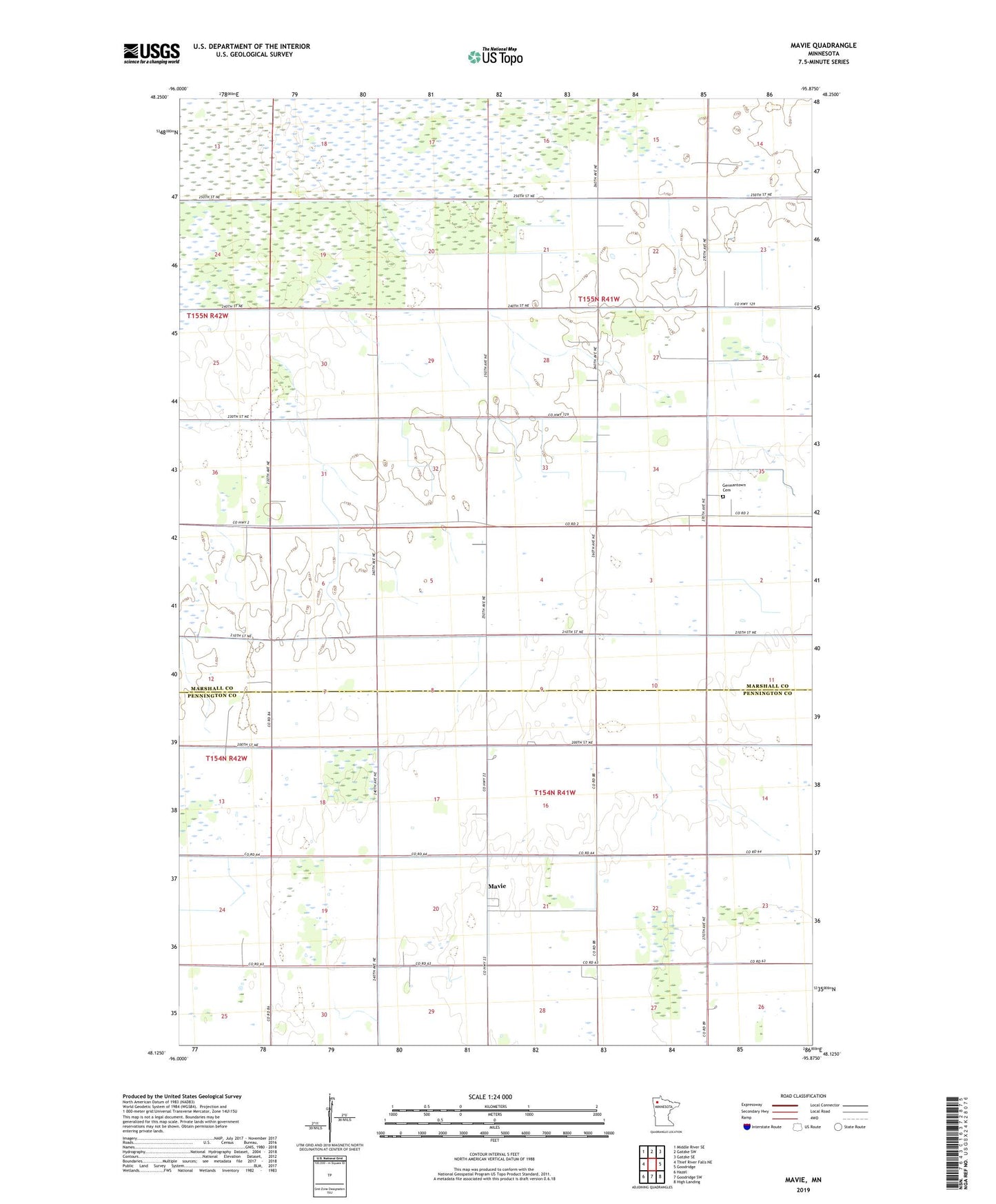
2022 topographic map quadrangle Mavie in the state of Minnesota. Scale: 1:24000. Based on the newly updated USGS 7.5' US Topo map series, this map is in the following counties: Marshall, Pennington. The map contains contour data, water features, and other items you are used to seeing on USGS maps, but also has updated roads and other features. This is the next generation of topographic maps. Printed on high-quality waterproof paper with UV fade-resistant inks.
Quads adjacent to this one:
West: Thief River Falls NE
Northwest: Middle River SE
North: Gatzke SW
Northeast: Gatzke SE
East: Goodridge
Southeast: High Landing
South: Goodridge SW
Southwest: Hazel
This map covers the same area as the classic USGS quad with code o48095b8.
Contains the following named places: County Ditch Number Thirtyone, County Ditch Number Twentyseven, Germantown Cemetery, Germantown Post Office, Judicial Ditch Number Eighteen, Mavie, Mavie Post Office, Mavie Railroad Station, Township of Cloverleaf, Township of Grand Plain