MyTopo
Gibbon Minnesota US Topo Map
Couldn't load pickup availability
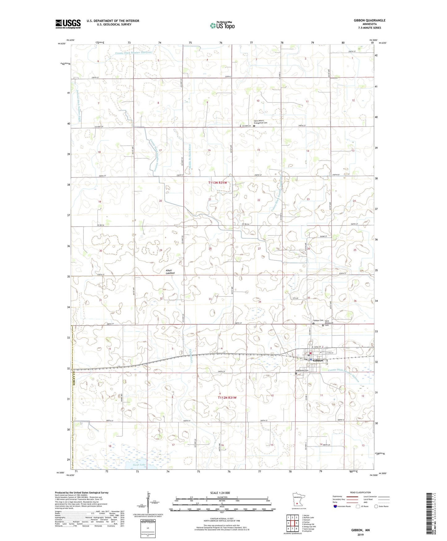
2019 topographic map quadrangle Gibbon in the state of Minnesota. Scale: 1:24000. Based on the newly updated USGS 7.5' US Topo map series, this map is in the following counties: Sibley, Renville. The map contains contour data, water features, and other items you are used to seeing on USGS maps, but also has updated roads and other features. This is the next generation of topographic maps. Printed on high-quality waterproof paper with UV fade-resistant inks.
Quads adjacent to this one:
West: Fairfax
Northwest: Hector
North: Buffalo Lake
Northeast: Stewart
East: Winthrop SW
Southeast: Lafayette
South: Saint George
Southwest: Sleepy Eye NW
Contains the following named places: Alkali Lakebed, Augustana Cemetery, Augustana Lutheran Church, City of Gibbon, County Ditch Number Eleven, County Ditch Number Nineteen, County Ditch Number Thirteen A, County Ditch Number Twentytwo, Gaylord Branch Library, Gaylord Medical Clinic, Gaylord-Fairfax Winthrop School, Gibbon, Gibbon Cemetery, Gibbon Fire Department, Gibbon Police Department, Gibbon Post Office, Gibbon Trailer Park, Immanuel Lutheran Church, Immanuel Lutheran School, Judicial Ditch Number Seven, Kent Field, Saint Peter's Evangelical Cemetery, Saint Peters Lutheran Church, Saint Peters School, Saint Willebrord Catholic Church, Saint Willibrord Cemetery, Township of Moltke, ZIP Code: 55335