MyTopo
Stewart Minnesota US Topo Map
Couldn't load pickup availability
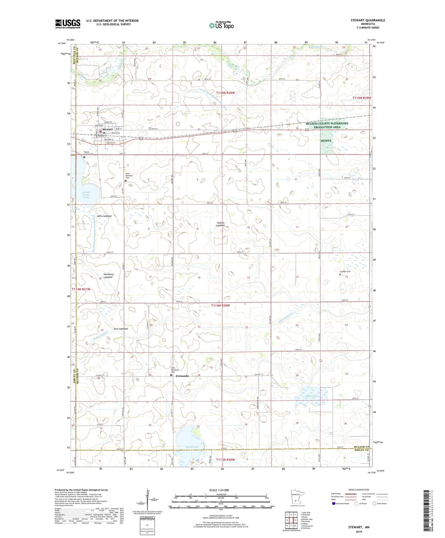
2022 topographic map quadrangle Stewart in the state of Minnesota. Scale: 1:24000. Based on the newly updated USGS 7.5' US Topo map series, this map is in the following counties: McLeod, Sibley, Renville. The map contains contour data, water features, and other items you are used to seeing on USGS maps, but also has updated roads and other features. This is the next generation of topographic maps. Printed on high-quality waterproof paper with UV fade-resistant inks.
Quads adjacent to this one:
West: Buffalo Lake
Northwest: Lake Allie
North: Heatwole
Northeast: Biscay
East: Brownton
Southeast: Winthrop
South: Winthrop SW
Southwest: Gibbon
This map covers the same area as the classic USGS quad with code o44094f4.
Contains the following named places: City of Stewart, County Ditch Number Sixtyfour, County Ditch Number Thirtynine, Draeger Cemetery, Fernando, Fernando Post Office, Glencoe Regional Health Services Center, Halls Lakebed, Judicial Ditch Number Fifteen, Judicial Ditch Number Seventeen, Kujas Lake, Kujas Lake State Wildlife Management Area, Nutter Lakebed, Remus Trailer Lots, Round Grove Cemetery, Round Grove Lake, Round Grove Lake Dam, Saint Boniface Cemetery, Saint Matthew Church, Saint Matthew's Cemetery, Showburg Lakebed, Stewart, Stewart Fire Department, Stewart Police Department, Stewart Post Office, Stewart Village Hall, Township of Round Grove, Twin Lakebed, Ward Lake, ZIP Code: 55385