MyTopo
Godahl Minnesota US Topo Map
Couldn't load pickup availability
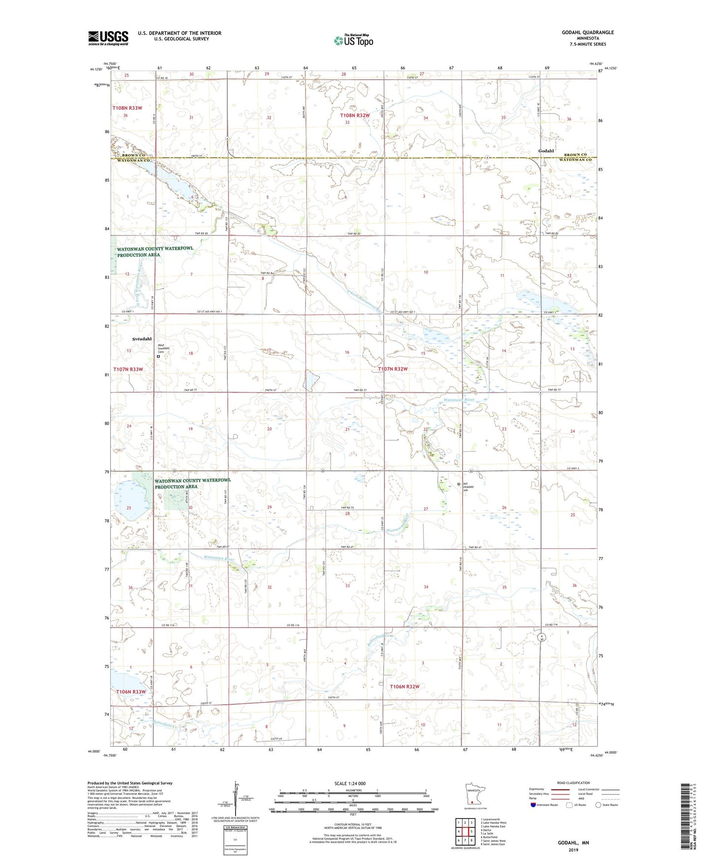
2019 topographic map quadrangle Godahl in the state of Minnesota. Scale: 1:24000. Based on the newly updated USGS 7.5' US Topo map series, this map is in the following counties: Watonwan, Brown. The map contains contour data, water features, and other items you are used to seeing on USGS maps, but also has updated roads and other features. This is the next generation of topographic maps. Printed on high-quality waterproof paper with UV fade-resistant inks.
Quads adjacent to this one:
West: Darfur
Northwest: Leavenworth
North: Lake Hanska West
Northeast: Lake Hanska East
East: La Salle
Southeast: Saint James East
South: Saint James West
Southwest: Butterfield
Contains the following named places: Albion Church, Cottonwood Lake, County Ditch Number Four, East Sveadahl Cemetery, East Sveadahl Church, Ewy Lake, Godahl, Judicial Ditch Number Five, KXAX-FM (Saint James), Mulligan State Wildlife Management Area, North Fork Watonwan River, Sveadahl, Sveadahl Lutheran Church, Sveadahl Post Office, Township of Nelson, Voss State Wildlife Management Area, West Sveadahl Cemetery