MyTopo
Saint James East Minnesota US Topo Map
Couldn't load pickup availability
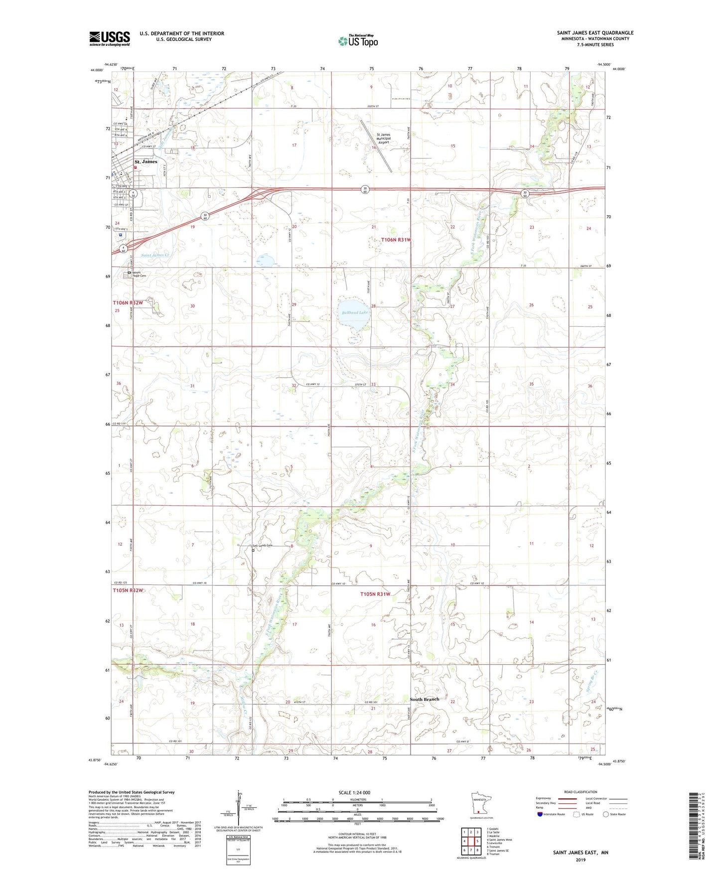
2022 topographic map quadrangle Saint James East in the state of Minnesota. Scale: 1:24000. Based on the newly updated USGS 7.5' US Topo map series, this map is in the following counties: Watonwan. The map contains contour data, water features, and other items you are used to seeing on USGS maps, but also has updated roads and other features. This is the next generation of topographic maps. Printed on high-quality waterproof paper with UV fade-resistant inks.
Quads adjacent to this one:
West: Saint James West
Northwest: Godahl
North: La Salle
Northeast: Madelia
East: Lewisville
Southeast: Truman
South: Saint James SE
Southwest: Trimont
This map covers the same area as the classic USGS quad with code o43094h5.
Contains the following named places: Ashippun Post Office Historical Marker, Bullhead Lake, City of Saint James, County Ditch Number One, Deer Park, First Lutheran Church, Highland Park Baptist Church, Judicial Ditch Number Thirtyfive, Mayo Clinic Health System - Saint James Medical Center, Mount Hope Cemetery, Northside Elementary School, Rosendale State Wildlife Management Area, Saint James Ambulance, Saint James Country Club, Saint James Family Clinic, Saint James Fire Department, Saint James Hospital, Saint John's Lutheran Church, Saint Johns School, Saint Paul's Lutheran Church, Saint Paul's Lutheran School, Sell-Lamb Cemetery, South Branch, South Branch Post Office, Southside Park, St James Municipal Airport, Township of Rosendale, Township of South Branch, Watonwan County, Watonwan County Fairgrounds, Watonwan River Rest Area, Willow Creek