MyTopo
Goodhue East Minnesota US Topo Map
Couldn't load pickup availability
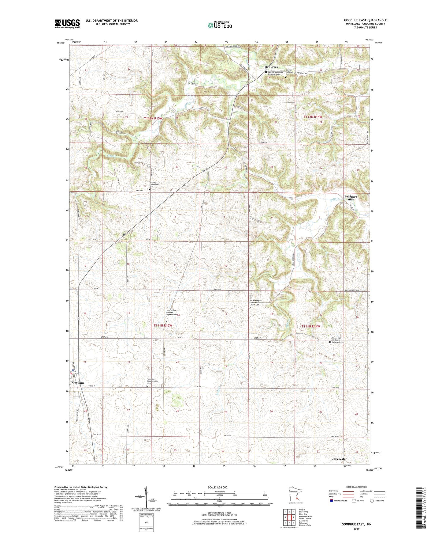
2019 topographic map quadrangle Goodhue East in the state of Minnesota. Scale: 1:24000. Based on the newly updated USGS 7.5' US Topo map series, this map is in the following counties: Goodhue. The map contains contour data, water features, and other items you are used to seeing on USGS maps, but also has updated roads and other features. This is the next generation of topographic maps. Printed on high-quality waterproof paper with UV fade-resistant inks.
Quads adjacent to this one:
West: Goodhue West
Northwest: Welch
North: Red Wing
Northeast: Bay City
East: Lake City NW
Southeast: Zumbro Falls
South: Mazeppa
Southwest: Zumbrota
Contains the following named places: Belvidere Mills, Belvidere Mills Post Office, German Evangelical Cemetery, German Lutheran Cemetery, German Methodist Episcopal Cemetery, Goodhue, Goodhue Fire and Rescue, Goodhue Police Department, Goodhue Post Office, Goodhue Presbyterian Cemetery, Hay Creek, Hay Creek Campground, Haycreek Post Office, Hof Norwegian Lutheran Church Cemetery, Immanuel Lutheran Church, Immanuel Lutheran School, Norwegian Methodist Episcopal Cemetery, Saint John's German Lutheran Cemetery, Saint John's Lutheran Church, Saint Johns School, Saint Mary's Catholic Church, Timms Dairy Farm, Township of Featherstone, Township of Goodhue, West Fork Group Structure Number 1 Dam, West Fork Group Structure Number 2 Dam, ZIP Code: 55027