MyTopo
Lake City NW Minnesota US Topo Map
Couldn't load pickup availability
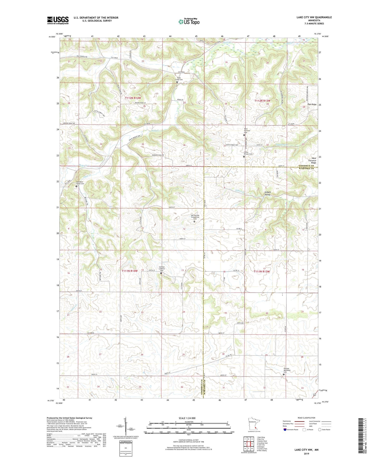
2022 topographic map quadrangle Lake City NW in the state of Minnesota. Scale: 1:24000. Based on the newly updated USGS 7.5' US Topo map series, this map is in the following counties: Goodhue, Wabasha. The map contains contour data, water features, and other items you are used to seeing on USGS maps, but also has updated roads and other features. This is the next generation of topographic maps. Printed on high-quality waterproof paper with UV fade-resistant inks.
Quads adjacent to this one:
West: Goodhue East
Northwest: Red Wing
North: Bay City
Northeast: Maiden Rock
East: Lake City
Southeast: West Albany
South: Zumbro Falls
Southwest: Mazeppa
This map covers the same area as the classic USGS quad with code o44092d4.
Contains the following named places: Belvidere Union Cemetery, Clear Creek, Corles Private Cemetery, German Lutheran Cemetery, German Methodist Cemetery, Old German Evangelical Cemetery, R Rusch Dam, Saint Peters Church, Township of Belvidere, Township of Hay Creek, Wells Creek Cemetery, West Florence Cemetery, West Florence Immanuel Church