MyTopo
Goodhue West Minnesota US Topo Map
Couldn't load pickup availability
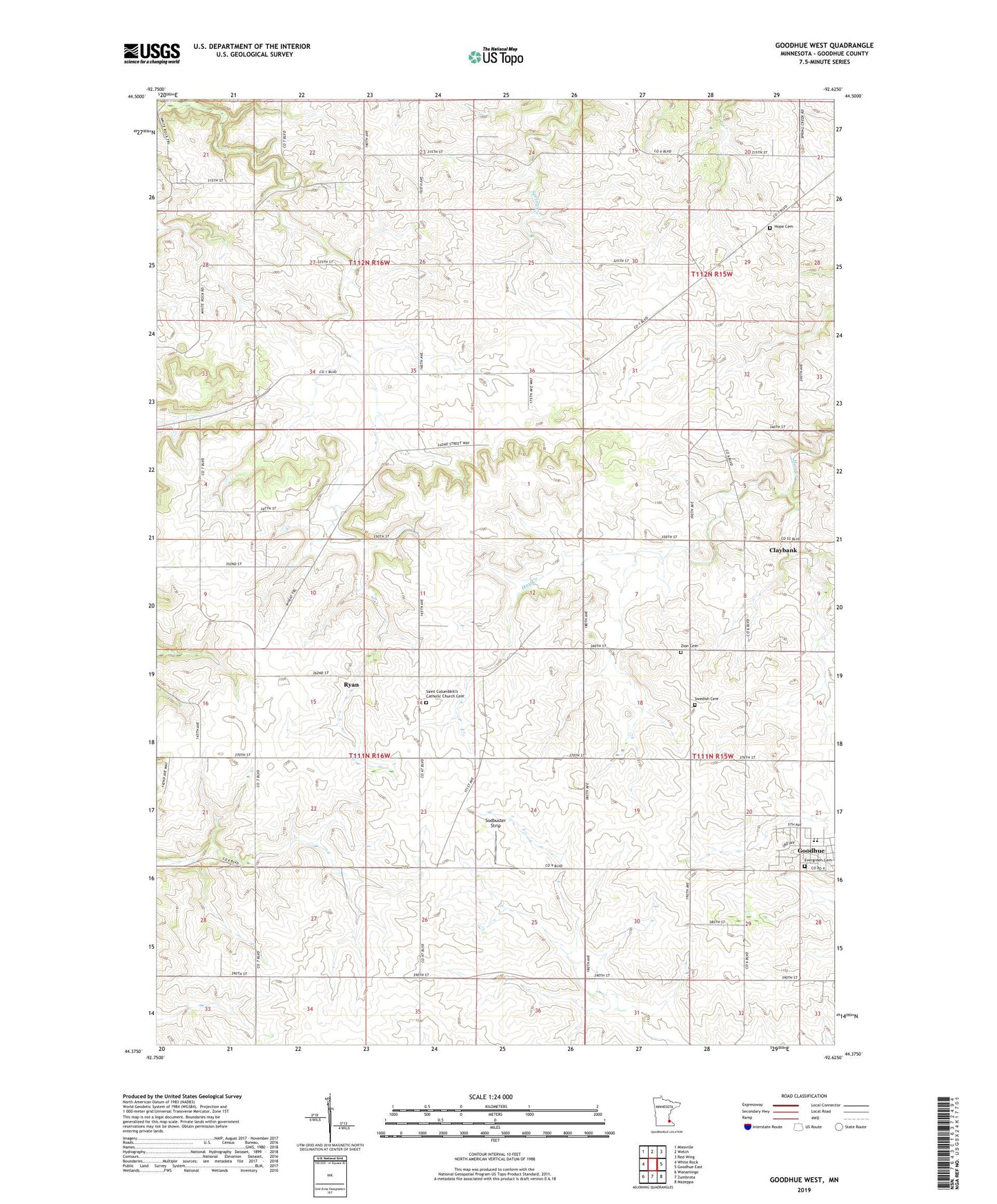
2019 topographic map quadrangle Goodhue West in the state of Minnesota. Scale: 1:24000. Based on the newly updated USGS 7.5' US Topo map series, this map is in the following counties: Goodhue. The map contains contour data, water features, and other items you are used to seeing on USGS maps, but also has updated roads and other features. This is the next generation of topographic maps. Printed on high-quality waterproof paper with UV fade-resistant inks.
Quads adjacent to this one:
West: White Rock
Northwest: Miesville
North: Welch
Northeast: Red Wing
East: Goodhue East
Southeast: Mazeppa
South: Zumbrota
Southwest: Wanamingo
Contains the following named places: Cecil Franklin Dam, City of Goodhue, Claybank, Claybank Post Office, Evergreen Cemetery, Goodhue County, Goodhue Public Schools, Holy Trinity Catholic Church, Hope Cemetery, Ryan, Ryan Post Office, Saint Columbkill's Catholic Church Cemetery, Saint Columkills Church, Saint Luke's Lutheran Church, Saint Peter's Lutheran Church, Sodbuster Strip, Swedish Cemetery, Township of Belle Creek, Zion Cemetery, Zion Church