MyTopo
Wanamingo Minnesota US Topo Map
Couldn't load pickup availability
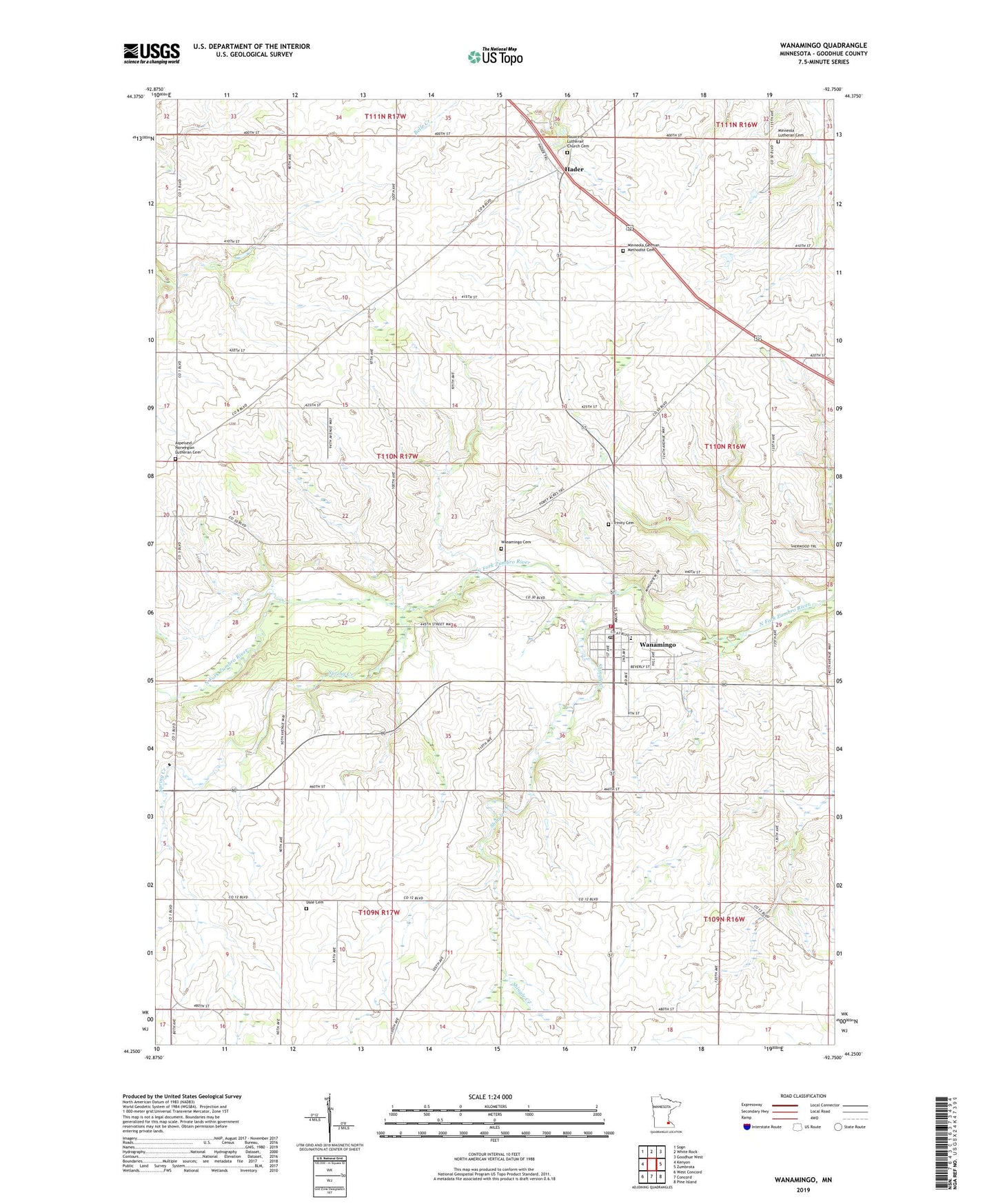
2022 topographic map quadrangle Wanamingo in the state of Minnesota. Scale: 1:24000. Based on the newly updated USGS 7.5' US Topo map series, this map is in the following counties: Goodhue. The map contains contour data, water features, and other items you are used to seeing on USGS maps, but also has updated roads and other features. This is the next generation of topographic maps. Printed on high-quality waterproof paper with UV fade-resistant inks.
Quads adjacent to this one:
West: Kenyon
Northwest: Sogn
North: White Rock
Northeast: Goodhue West
East: Zumbrota
Southeast: Pine Island
South: Concord
Southwest: West Concord
This map covers the same area as the classic USGS quad with code o44092c7.
Contains the following named places: Aspelund Emmanuel Church, Aspelund Norwegian Lutheran Cemetery, City of Wanamingo, Dale Cemetery, Dale Church, Hader, Hader Post Office, Kenyon - Wanamingo Elementary School, L Jackson Pond Dam, Minneola Church, Minneola German Methodist Cemetery, Minneola Lutheran Cemetery, Nazareth Lutheran Church Cemetery, New Life Church, Olmsted Medical Center, Riverview Manor, Shingle Creek, Spring Creek, Township of Wanamingo, Trinity Cemetery, Trinity Lutheran Church, Wanamingo, Wanamingo Cemetery, Wanamingo Fire Department, Wanamingo Four Square Church, Wanamingo Lutheran Church, Wanamingo Police Department, Wanamingo Post Office, ZIP Code: 55983