MyTopo
Hancock SW Minnesota US Topo Map
Couldn't load pickup availability
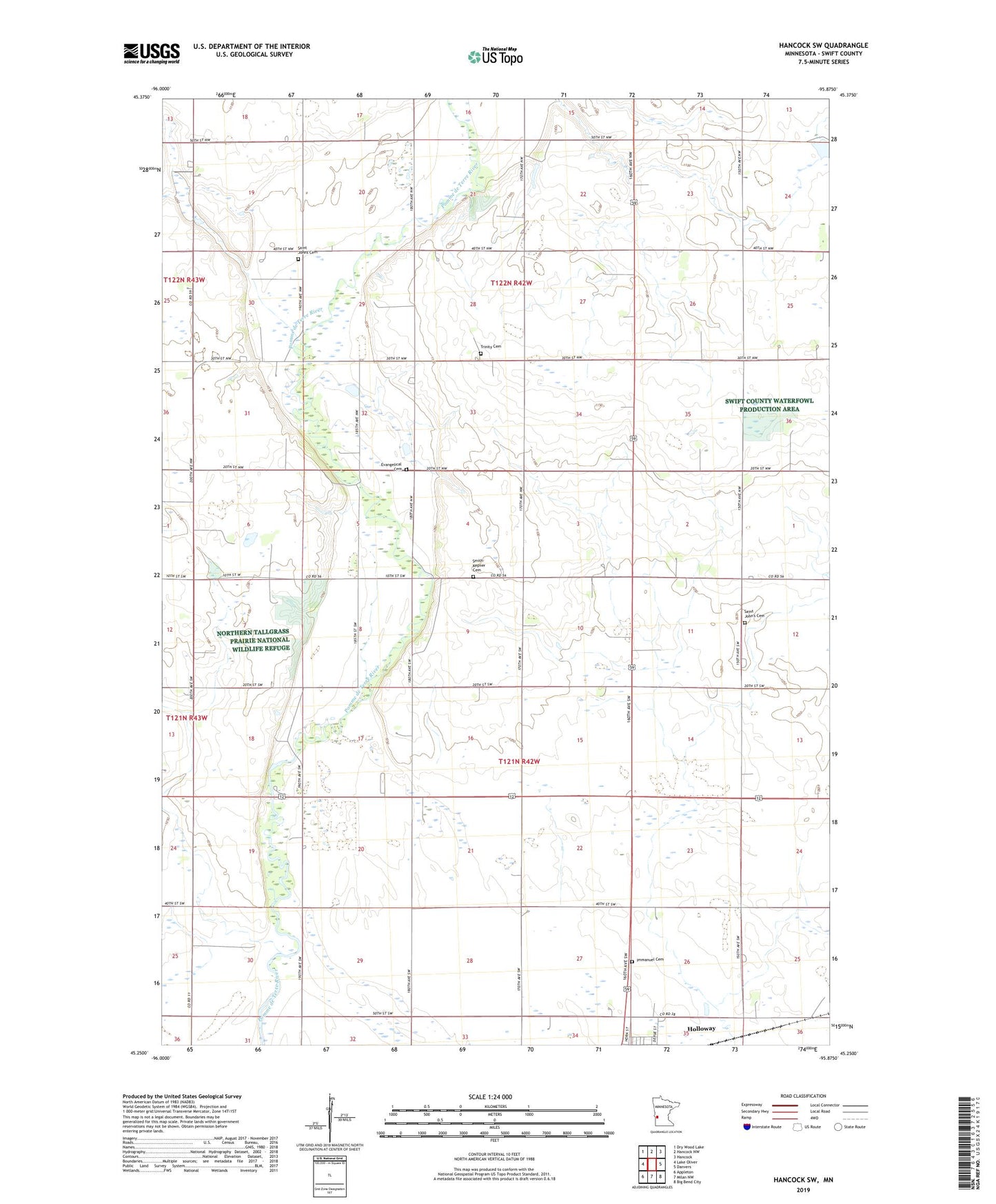
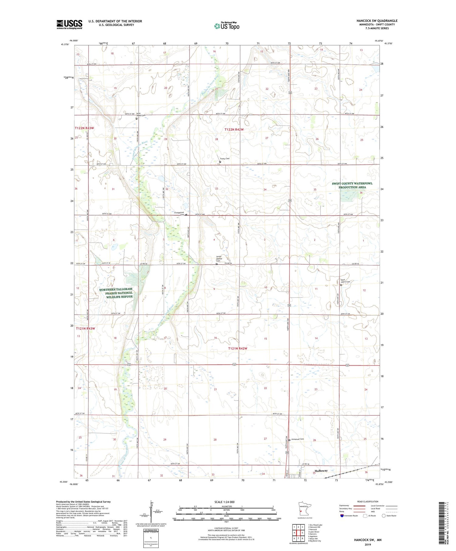
2019 topographic map quadrangle Hancock SW in the state of Minnesota. Scale: 1:24000. Based on the newly updated USGS 7.5' US Topo map series, this map is in the following counties: Swift. The map contains contour data, water features, and other items you are used to seeing on USGS maps, but also has updated roads and other features. This is the next generation of topographic maps. Printed on high-quality waterproof paper with UV fade-resistant inks.
Quads adjacent to this one:
West: Lake Oliver
Northwest: Dry Wood Lake
North: Hancock NW
Northeast: Hancock
East: Danvers
Southeast: Big Bend City
South: Milan NW
Southwest: Appleton
Contains the following named places: Berthold Koosmann Dam, Ehrenberg State Wildlife Management Area, Evangelical Cemetery, Frank Schlieman Dam, Immanuel Cemetery, Koosmann Farms, Marquardt Dam, Pomme De Terre Rest Area, Saint Johns Cemetery, Saint John's Cemetery, Saint Johns Church, Smith-Kepner Cemetery, Township of Fairfield, Township of Moyer, Trinity Cemetery, Trinity Church, ZIP Code: 56249