MyTopo
Appleton Minnesota US Topo Map
Couldn't load pickup availability
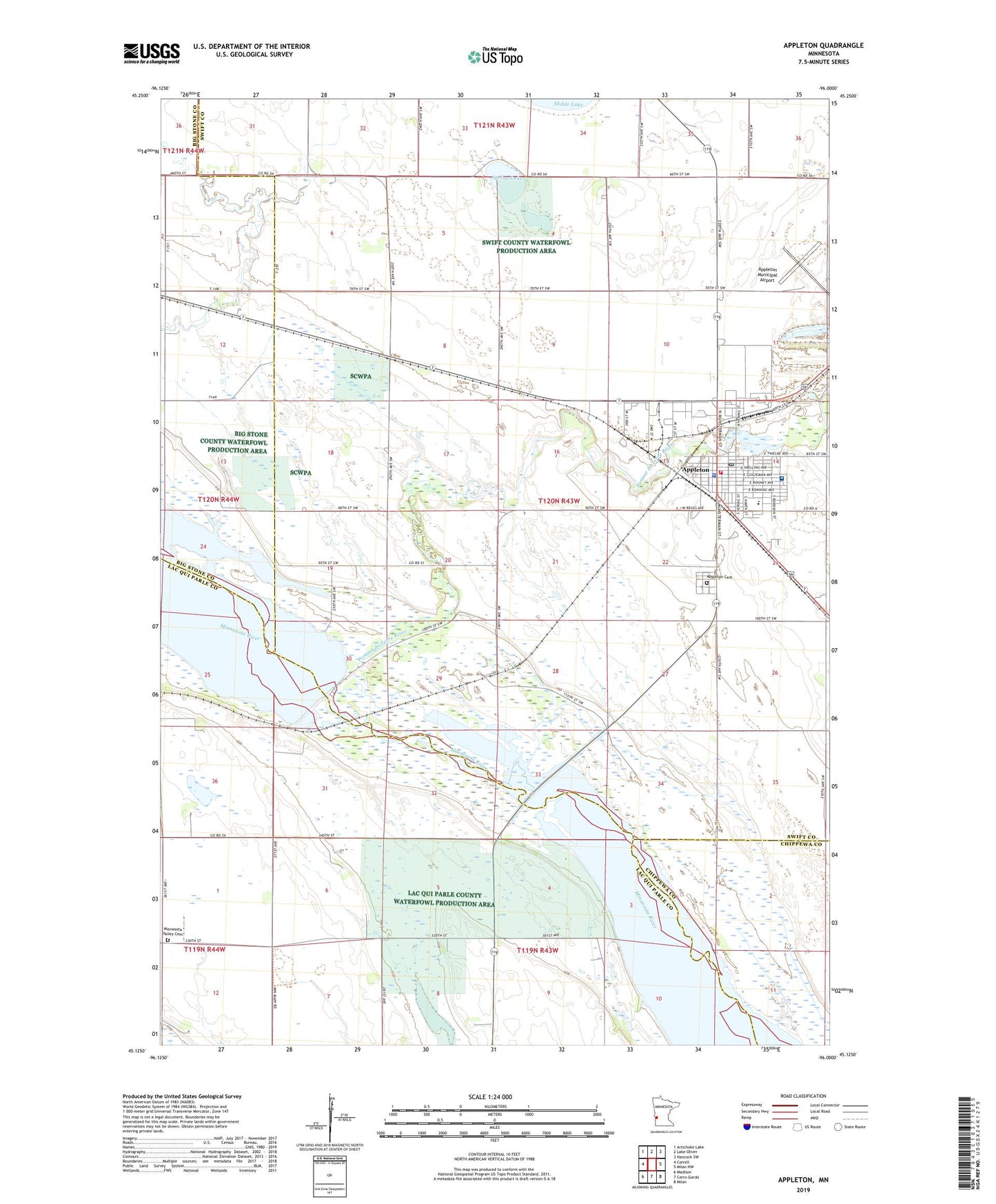
2022 topographic map quadrangle Appleton in the state of Minnesota. Scale: 1:24000. Based on the newly updated USGS 7.5' US Topo map series, this map is in the following counties: Swift, Lac qui Parle, Big Stone, Chippewa. The map contains contour data, water features, and other items you are used to seeing on USGS maps, but also has updated roads and other features. This is the next generation of topographic maps. Printed on high-quality waterproof paper with UV fade-resistant inks.
Quads adjacent to this one:
West: Correll
Northwest: Artichoke Lake
North: Lake Oliver
Northeast: Hancock SW
East: Milan NW
Southeast: Milan
South: Cerro Gordo
Southwest: Madison
This map covers the same area as the classic USGS quad with code o45096b1.
Contains the following named places: Appleton, Appleton Ambulance Service, Appleton Area Health Services Hospital, Appleton Cemetery, Appleton City Library, Appleton Elementary School, Appleton Fire Department, Appleton Golf Club, Appleton Lions Park Campground, Appleton Medical Clinic, Appleton Municipal Airport, Appleton Municipal Nursing Home, Appleton Police Department, Appleton Post Office, City of Appleton, First Baptist Church, First Congregational Church, First United Methodist Church, KRSU-FM (Appleton), KWCM-TV (Appleton), Lac Qui Parle County Waterfowl Production Area, Marsh Lake, Marsh Lake Dam, Mill Pond, Minnesota Valley Cemetery, Minnesota Valley Church, Pomme de Terre River, Pomme de Terre River Dam, Saint John's Catholic Church, Spring Lake, Telford Airport, Township of Appleton, Trinity Lutheran Church, Word Fellowship Church, Zion Lutheran Church, ZIP Code: 56208