MyTopo
Heilberger Lake Minnesota US Topo Map
Couldn't load pickup availability
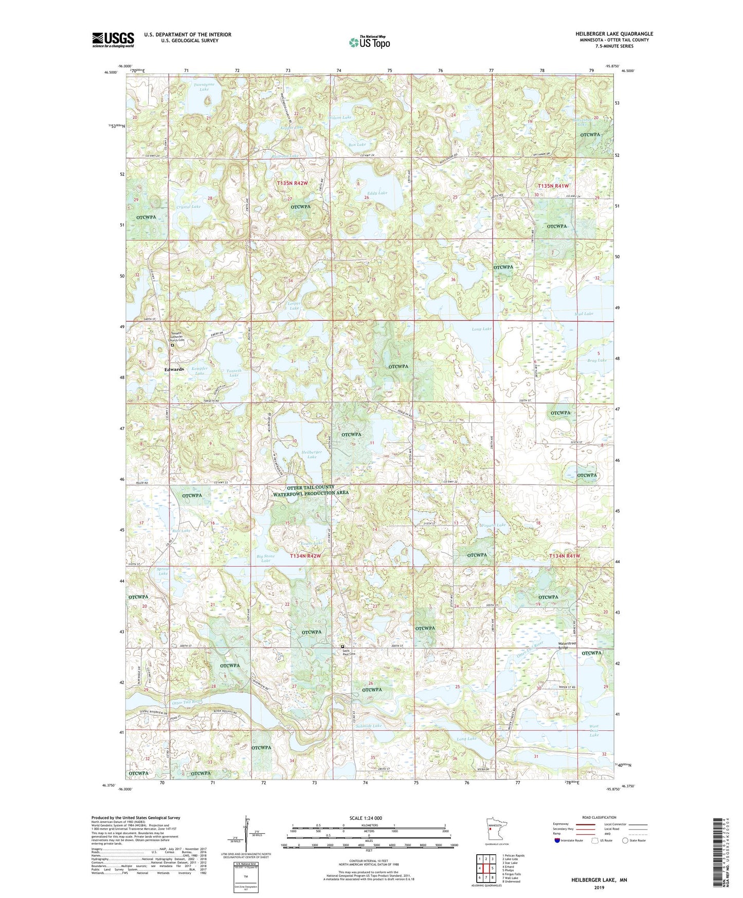
2019 topographic map quadrangle Heilberger Lake in the state of Minnesota. Scale: 1:24000. Based on the newly updated USGS 7.5' US Topo map series, this map is in the following counties: Otter Tail. The map contains contour data, water features, and other items you are used to seeing on USGS maps, but also has updated roads and other features. This is the next generation of topographic maps. Printed on high-quality waterproof paper with UV fade-resistant inks.
Quads adjacent to this one:
West: Erhard
Northwest: Pelican Rapids
North: Lake Lida
Northeast: Star Lake
East: Phelps
Southeast: Underwood
South: Wall Lake
Southwest: Fergus Falls
Contains the following named places: Anderson Lake, Big Stone Lake, Bon Lake, Bracket Lake, Bray Lake, Campers Cove, Crystal Lake, Eddy Lake, Edwards, Edwards Post Office, Edwards School, Elliott School, Erhard-Maplewood Church, Evans Lake, Fogard Lake, Heilberger Lake, High Island Lake, Horseshoe Lake, Johnson Lake, Jorgenson Structure Dam, Kempfer Lake, Kepple Lake, Leeper Lake, Long Lake, Mud Lake, Railroad Lake, Rice Lake, Rumsey Post Office, Saint Paul Cemetery, Saint Paul Church, Schmidt Lake, School Number 120, School Number 145, School Number 161, School Number 169, School Number 193, School Number 24, Sproul Lake, Tonseth Lake, Tonseth Lutheran Church Cemetery, Township of Friberg, Township of Maplewood, Twentyone Lake, Waterstreet Bridge, Weggeland Post Office, West Lost Lake, Wilson Lake, Worden Post Office