MyTopo
Lake Lida Minnesota US Topo Map
Couldn't load pickup availability
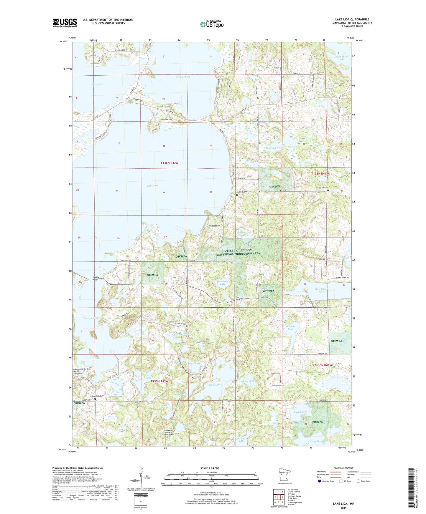
2022 topographic map quadrangle Lake Lida in the state of Minnesota. Scale: 1:24000. Based on the newly updated USGS 7.5' US Topo map series, this map is in the following counties: Otter Tail. The map contains contour data, water features, and other items you are used to seeing on USGS maps, but also has updated roads and other features. This is the next generation of topographic maps. Printed on high-quality waterproof paper with UV fade-resistant inks.
Quads adjacent to this one:
West: Pelican Rapids
Northwest: Cormorant
North: Lake Franklin
Northeast: Vergas
East: Star Lake
Southeast: Phelps
South: Heilberger Lake
Southwest: Erhard
This map covers the same area as the classic USGS quad with code o46095e8.
Contains the following named places: Andrew Lake, Arthur Post Office, Bass Lake, Beaver Lake, Beers Lake, Beiningen Lake, Bessie Post Office, Big Crow Lake, Cataract Lake, Cow Lake, Crystal Lake, Crystal Lida Resort and RV Park, Deadwood Lake, East Lake Lida Cemetery, Femling Lake, Fladmark Lake, Fritz Lake, Grass Lake, James Lake, Lake Field, Lake Lida, Lake Lida Baptist Cemetery, Lake Lizzie, Lida Post Office, Little Crow Lake, Long Lake, Maplewood Church, Maplewood Lutheran Church Cemetery, Maplewood State Park, Round Lake, Scandinavian Christian Mission Church Cemetery, Slim Lake, South Arm Lake Lida, Stoney Bar, Township of Lida, Venstrom Lake, West Dora Cemetery, West Silent Lake, West Spirit Lake