
MyTopo
Idington Minnesota US Topo Map
Couldn't load pickup availability
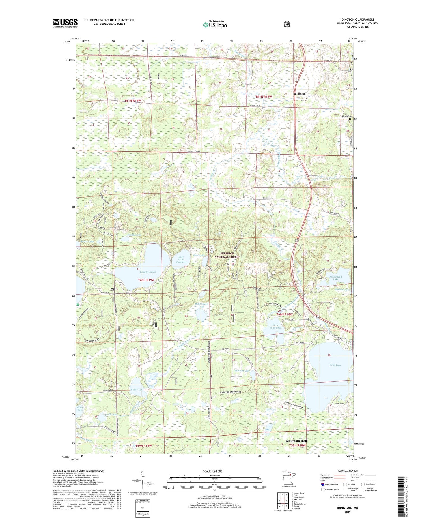
2019 topographic map quadrangle Idington in the state of Minnesota. Scale: 1:24000. Based on the newly updated USGS 7.5' US Topo map series, this map is in the following counties: St. Louis. The map contains contour data, water features, and other items you are used to seeing on USGS maps, but also has updated roads and other features. This is the next generation of topographic maps. Printed on high-quality waterproof paper with UV fade-resistant inks.
Quads adjacent to this one:
West: Dark Lake
Northwest: Linden Grove
North: Cook
Northeast: Sassas Creek
East: Britt
Southeast: Virginia
South: Kinney
Southwest: Dewey Lake SE
Contains the following named places: Arrowhead Lake, Arrowhead Lake State Game Refuge, Beaver Lake, Belmont Lake, Birch Knob Lookout Tower, Candle Lake, Goat Lake, Idington, Idington Cemetery, Idington Station, Johnson Creek, Jutila Lake, Lake Fourteen, Lake Little Fourteen, Little Sand Lake, Moose Lake, Sand Lake, Sand Lake Chapel, Superior State Game Refuge, Unorganized Territory of Leander Lake, Unorganized Territory of Sand Lake, Watercress Creek, Watercress Lake, Wolfridge Golf Course, ZIP Code: 55710


