MyTopo
Dewey Lake SE Minnesota US Topo Map
Couldn't load pickup availability
Also explore the Dewey Lake SE Forest Service Topo of this same quad for updated USFS data
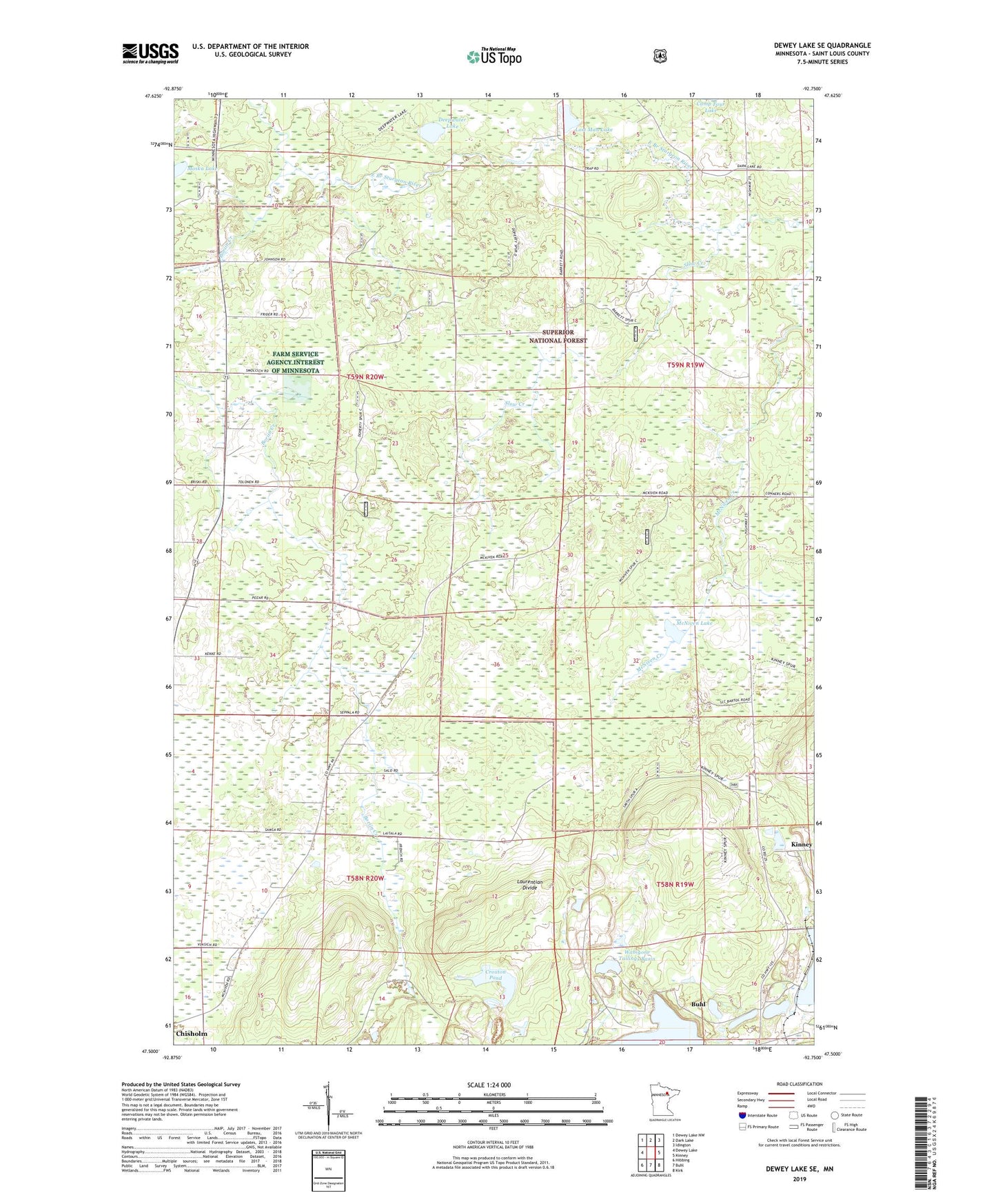
2022 topographic map quadrangle Dewey Lake SE in the state of Minnesota. Scale: 1:24000. Based on the newly updated USGS 7.5' US Topo map series, this map is in the following counties: St. Louis. The map contains contour data, water features, and other items you are used to seeing on USGS maps, but also has updated roads and other features. This is the next generation of topographic maps. Printed on high-quality waterproof paper with UV fade-resistant inks.
Quads adjacent to this one:
West: Dewey Lake
Northwest: Dewey Lake NW
North: Dark Lake
Northeast: Idington
East: Kinney
Southeast: Kirk
South: Buhl
Southwest: Hibbing
This map covers the same area as the classic USGS quad with code o47092e7.
Contains the following named places: Boriin Creek, Buhl Lookout Tower, Croxton Pond, Deepwater Lake, Drew-Syme Mine, Grant Mine, Horseshoe Lake, Lost Man Lake, Margaret Mine, McNiven Lake, Moska Lake, Shiras Mine, Slow Creek, Township of Balkan, Wabigon Mine, Wabigone Tailings Basin, Wabigone Tailings Dike, Wanless Mine, ZIP Code: 55719