MyTopo
Jeffers Minnesota US Topo Map
Couldn't load pickup availability
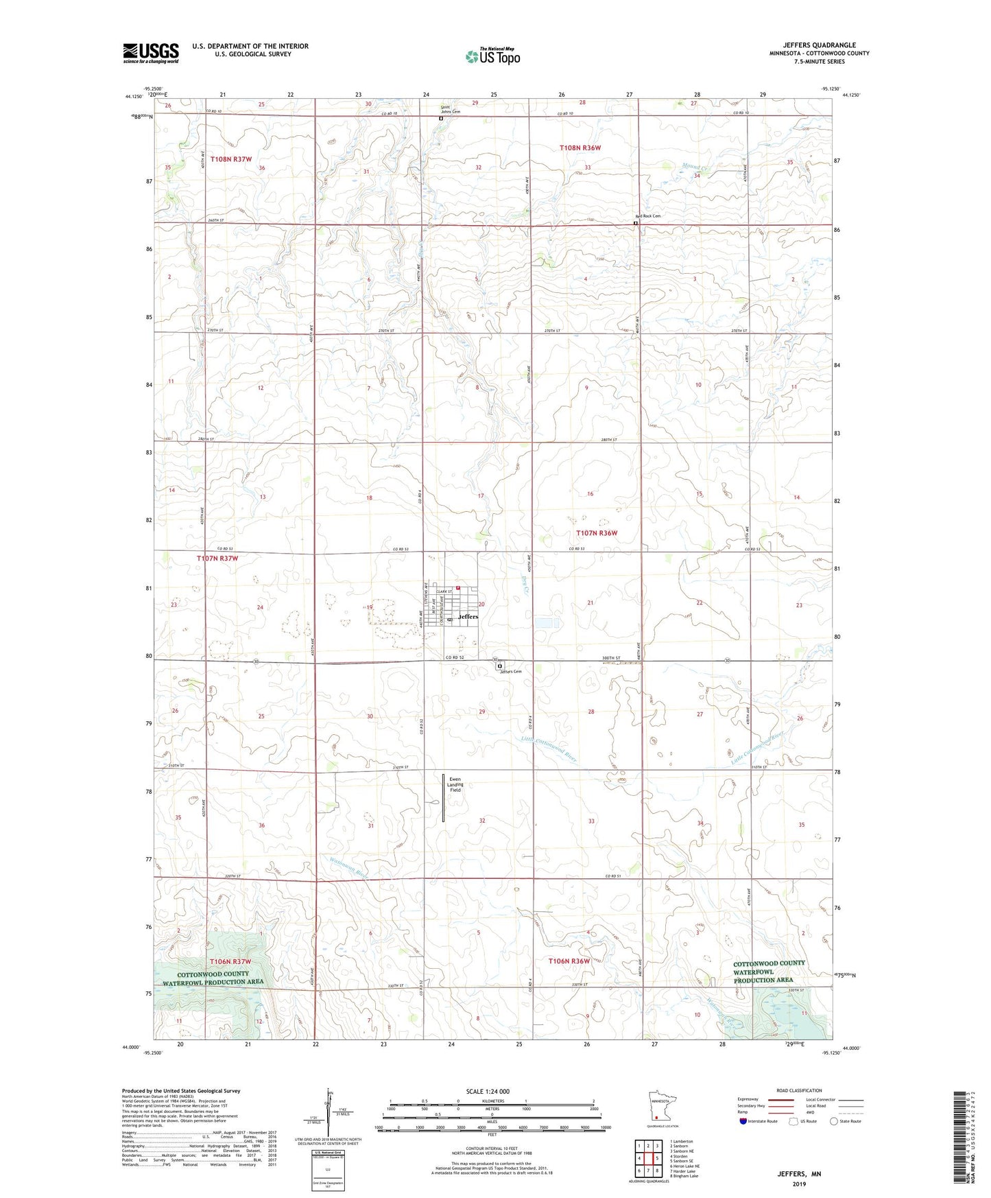
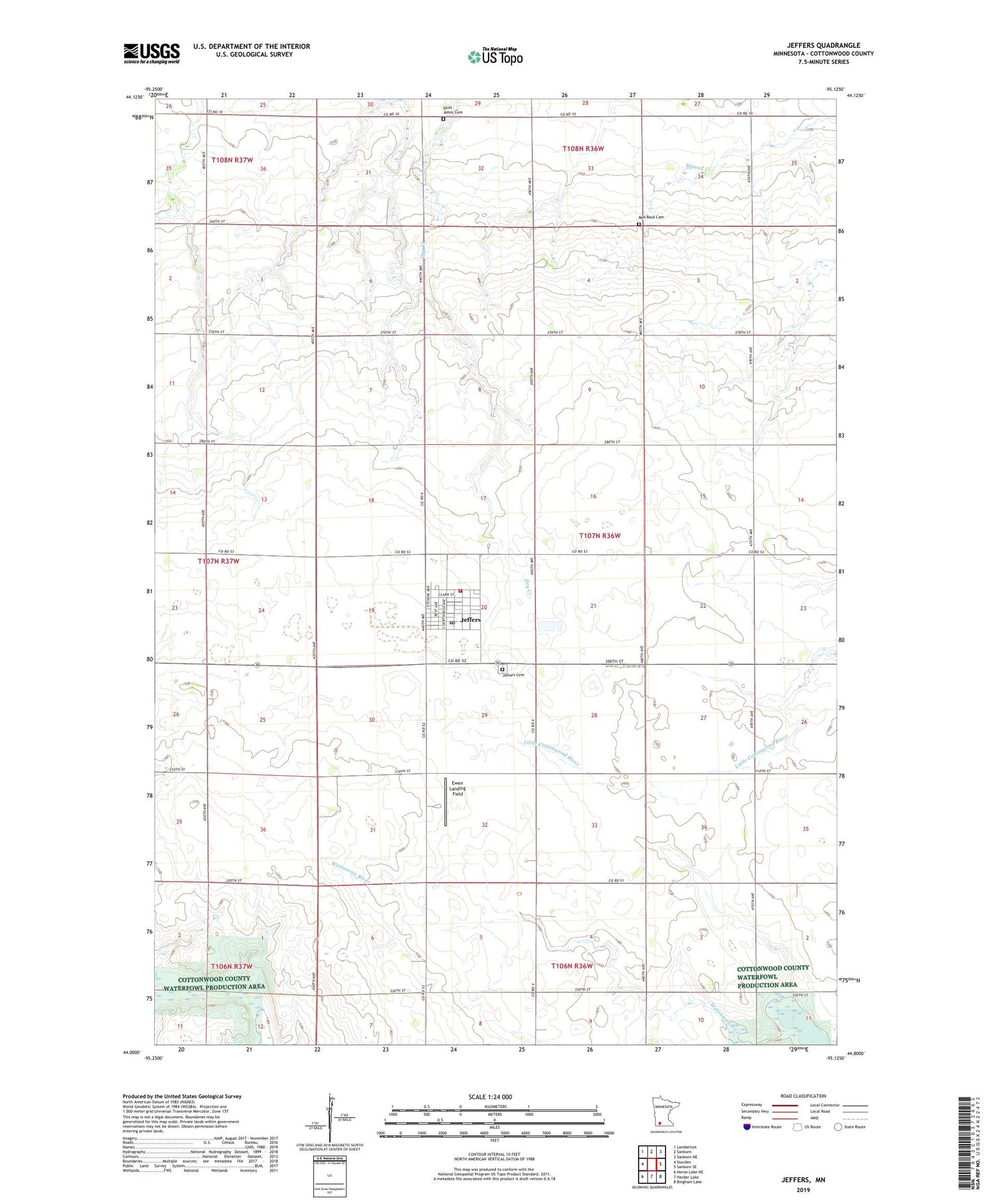
2019 topographic map quadrangle Jeffers in the state of Minnesota. Scale: 1:24000. Based on the newly updated USGS 7.5' US Topo map series, this map is in the following counties: Cottonwood. The map contains contour data, water features, and other items you are used to seeing on USGS maps, but also has updated roads and other features. This is the next generation of topographic maps. Printed on high-quality waterproof paper with UV fade-resistant inks.
Quads adjacent to this one:
West: Storden
Northwest: Lamberton
North: Sanborn
Northeast: Sanborn NE
East: Sanborn SE
Southeast: Bingham Lake
South: Harder Lake
Southwest: Heron Lake NE
Contains the following named places: City of Jeffers, Cottonwood County, Ewen Landing Field, Jeffers, Jeffers Ambulance Service, Jeffers Cemetery, Jeffers Post Office, Jeffers Village City Hall, Jeffers Volunteer Fire Department, Red Rock Cemetery, Red Rock Central Elementary School, Red Rock Church, Red Rock United Methodist Church, Saint Johns Cemetery, Township of Amboy, Trinity Lutheran Church, ZIP Code: 56145