MyTopo
Storden Minnesota US Topo Map
Couldn't load pickup availability
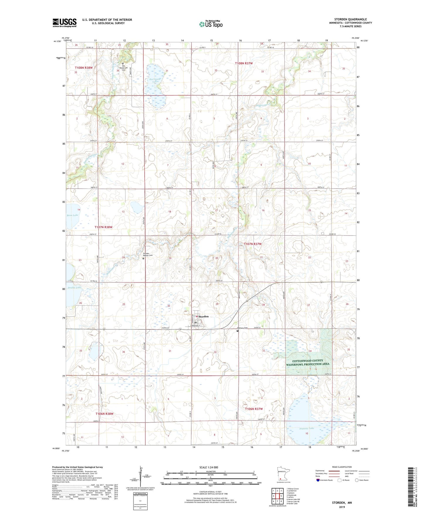
2022 topographic map quadrangle Storden in the state of Minnesota. Scale: 1:24000. Based on the newly updated USGS 7.5' US Topo map series, this map is in the following counties: Cottonwood. The map contains contour data, water features, and other items you are used to seeing on USGS maps, but also has updated roads and other features. This is the next generation of topographic maps. Printed on high-quality waterproof paper with UV fade-resistant inks.
Quads adjacent to this one:
West: Westbrook
Northwest: Walnut Grove
North: Lamberton
Northeast: Sanborn
East: Jeffers
Southeast: Harder Lake
South: Heron Lake NE
Southwest: Heron Lake NW
This map covers the same area as the classic USGS quad with code o44095a3.
Contains the following named places: Augusta Lake, Bean Lake, Bethany Cemetery, Bethany Lutheran Church, City of Storden, Clear Lake, County Ditch Number Fortytwo, County Ditch Number Thirtyseven, Double Lake, Highwater Park, Hurricane Lake, Hurricane State Wildlife Management Area, Old Westbrook Cemetery, Old Westbrook Church, Sara Park, Storden, Storden Baptist Cemetery, Storden Baptist Church, Storden Post Office, Storden Volunteer Fire Department, Township of Storden, ZIP Code: 56174