MyTopo
Kettle River Minnesota US Topo Map
Couldn't load pickup availability
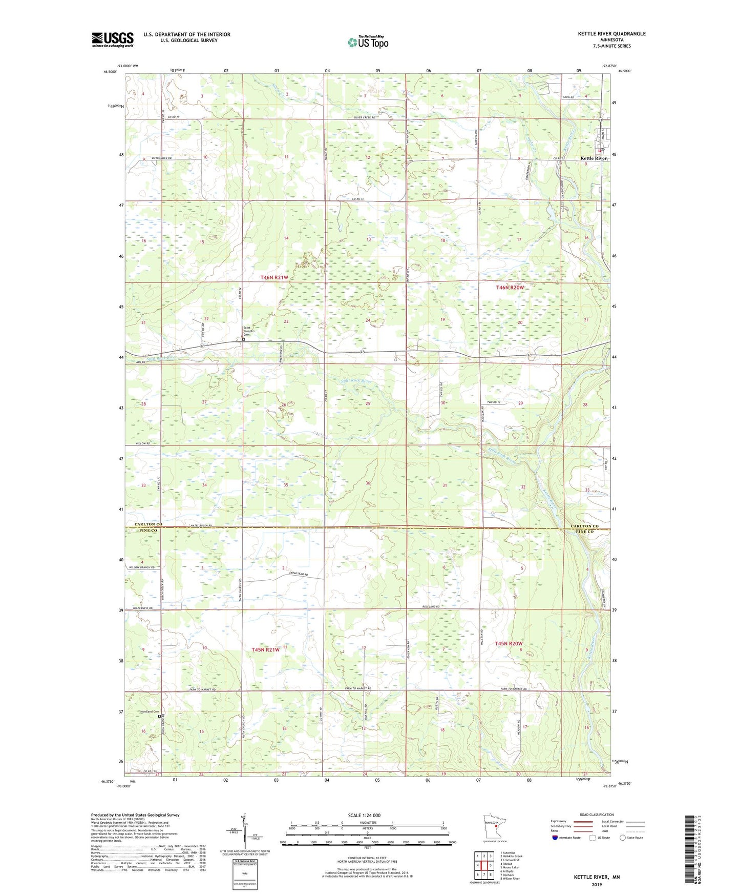
2019 topographic map quadrangle Kettle River in the state of Minnesota. Scale: 1:24000. Based on the newly updated USGS 7.5' US Topo map series, this map is in the following counties: Carlton, Pine. The map contains contour data, water features, and other items you are used to seeing on USGS maps, but also has updated roads and other features. This is the next generation of topographic maps. Printed on high-quality waterproof paper with UV fade-resistant inks.
Quads adjacent to this one:
West: Ronald
Northwest: Automba
North: Heikkila Creek
Northeast: Cromwell SE
East: Moose Lake
Southeast: Willow River
South: Denham
Southwest: Arthyde
Contains the following named places: City of Kettle River, Dead Moose River, Faith Church, Gillespie Brook, Holy Trinity Lutheran Church, Kettle River, Kettle River City Hall, Kettle River Fire Department, Kettle River Post Office, Nordland Cemetery, Polish National Church, Saint Joseph's Cemetery, Saint Josephs Church, Silver Creek, Split Rock River, Township of Birch Creek, Township of Split Rock, West Side Church, ZIP Code: 55783