MyTopo
Kinney Minnesota US Topo Map
Couldn't load pickup availability
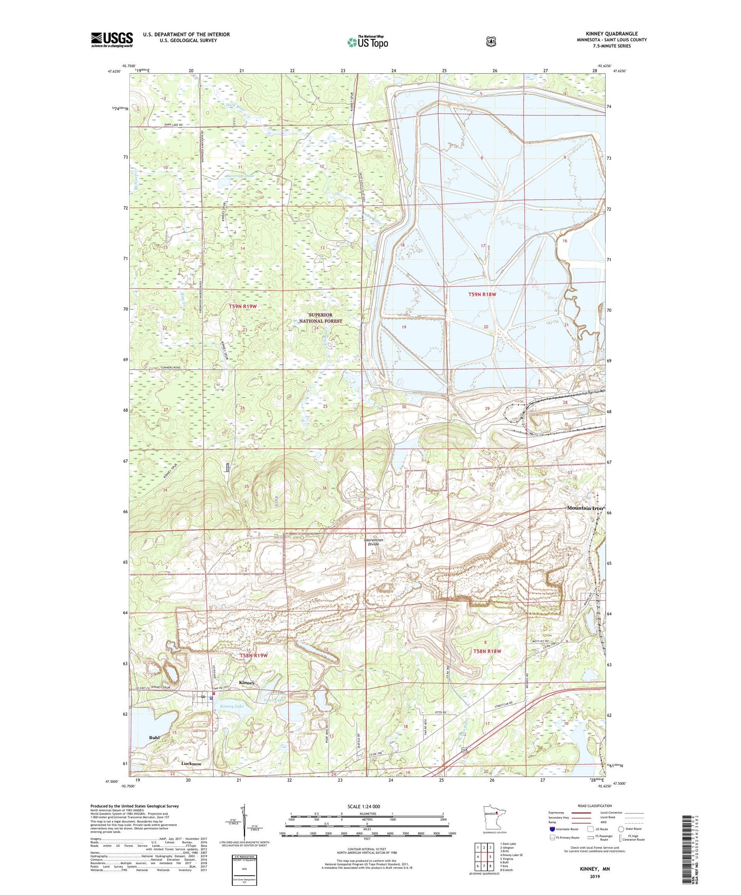
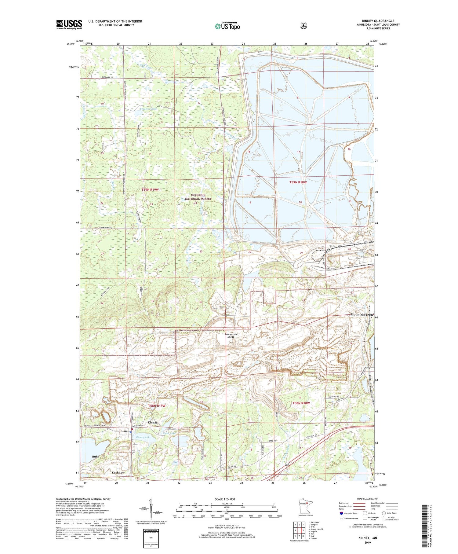
2019 topographic map quadrangle Kinney in the state of Minnesota. Scale: 1:24000. Based on the newly updated USGS 7.5' US Topo map series, this map is in the following counties: St. Louis. The map contains contour data, water features, and other items you are used to seeing on USGS maps, but also has updated roads and other features. This is the next generation of topographic maps. Printed on high-quality waterproof paper with UV fade-resistant inks.
Quads adjacent to this one:
West: Dewey Lake SE
Northwest: Dark Lake
North: Idington
Northeast: Britt
East: Virginia
Southeast: Eveleth
South: Kirk
Southwest: Buhl
Contains the following named places: Anderson School, Atkins Mine, City of Kinney, City of Mountain Iron, Forsyth Mine, Kinney, Kinney - Great Scott Fire Department Station 1, Kinney Lake, Kinney Police Department, Kinney Post Office, Kinney Public Library, Lucknow, McNiven Creek, Mesaba Quarry, Minntac Tailings Dike, Mott Mine, New Pilot Mine, Severson Lake, Seville-Midway Mine, Timber Creek, Township of Great Scott, Wanless Mine, Whiteside Mine, Yates Lake, ZIP Codes: 55713, 55758