MyTopo
Kirk Minnesota US Topo Map
Couldn't load pickup availability
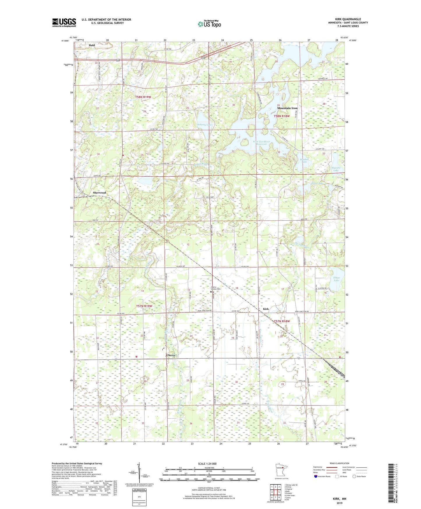
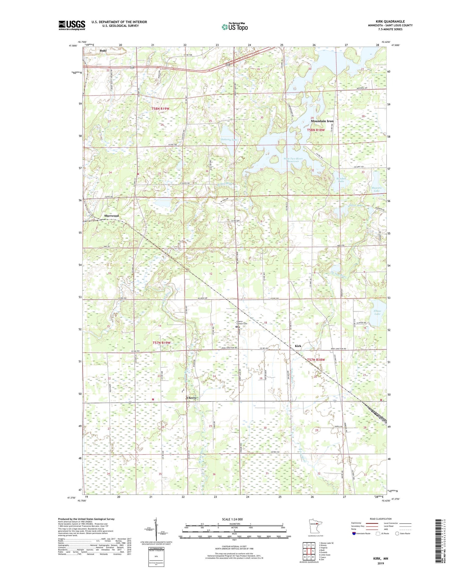
2019 topographic map quadrangle Kirk in the state of Minnesota. Scale: 1:24000. Based on the newly updated USGS 7.5' US Topo map series, this map is in the following counties: St. Louis. The map contains contour data, water features, and other items you are used to seeing on USGS maps, but also has updated roads and other features. This is the next generation of topographic maps. Printed on high-quality waterproof paper with UV fade-resistant inks.
Quads adjacent to this one:
West: Buhl
Northwest: Dewey Lake SE
North: Kinney
Northeast: Virginia
East: Eveleth
Southeast: Zim
South: Casco
Southwest: Little Swan
Contains the following named places: Bethel Church, Cherry, Cherry Post Office, Cherry Township Fire Department, Cherry-Clinton Cemetery, Clinton Volunteer Fire Department, Doherty Lake, Kendall Lake, Kirk, Majestic Lake, School Number 96, Sherwood, Silver Lake, Stahlberg-Mohr Airport, Town of Great Scott Fire Department Station 3, Township of Cherry, West Two River Reservoir, West Two Rivers Campground, West Two Rivers Dam, ZIP Codes: 55751, 55768