MyTopo
Knife River Minnesota US Topo Map
Couldn't load pickup availability
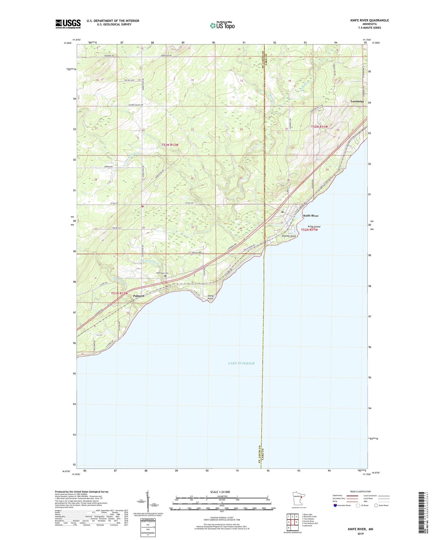
2019 topographic map quadrangle Knife River in the state of Minnesota. Scale: 1:24000. Based on the newly updated USGS 7.5' US Topo map series, this map is in the following counties: St. Louis, Lake. The map contains contour data, water features, and other items you are used to seeing on USGS maps, but also has updated roads and other features. This is the next generation of topographic maps. Printed on high-quality waterproof paper with UV fade-resistant inks.
Quads adjacent to this one:
West: French River
Northwest: Barrs Lake
North: McCarthy Creek
Northeast: Two Harbors
East: Two Harbors OE S
Southwest: Lakewood
Contains the following named places: Arthur V Rohweder Memorial Highway Historical Museum, Big Blaze Campground and Cabins, Big Sucker Creek, Buchanan Historical Marker, Clifton Volunteer Fire Department Station 2, Community Church, Duluth Township Police Department, Granite Point, Knife Island, Knife River, Knife River Census Designated Place, Knife River Lutheran Church, Knife River Post Office, Knife River Rest Area, Lake View Cemetery, Little Knife River, Little Sucker River, Palmers, Palmers Post Office, Palmers Station, Stanley Creek, Stony Point, Township of Duluth, WRSR-FM (Two Harbors), ZIP Code: 55609