MyTopo
French River Minnesota US Topo Map
Couldn't load pickup availability
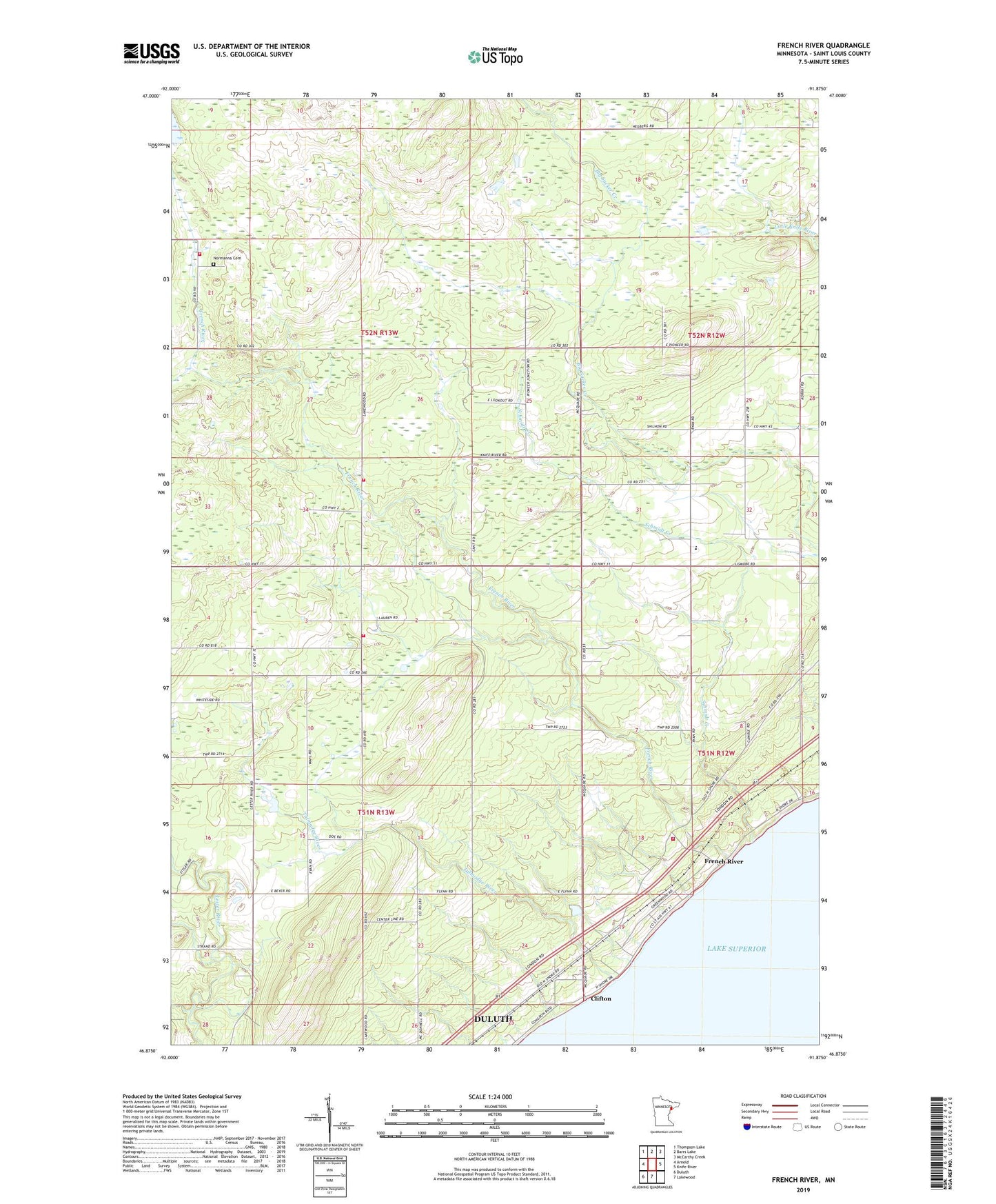
2022 topographic map quadrangle French River in the state of Minnesota. Scale: 1:24000. Based on the newly updated USGS 7.5' US Topo map series, this map is in the following counties: St. Louis. The map contains contour data, water features, and other items you are used to seeing on USGS maps, but also has updated roads and other features. This is the next generation of topographic maps. Printed on high-quality waterproof paper with UV fade-resistant inks.
Quads adjacent to this one:
West: Arnold
Northwest: Thompson Lake
North: Barrs Lake
Northeast: McCarthy Creek
East: Knife River
South: Lakewood
Southwest: Duluth
This map covers the same area as the classic USGS quad with code o46091h8.
Contains the following named places: Bloomingdale School, Chez Dam, Clifton, Clifton Post Office, Clifton Station, Clifton Volunteer Fire Department Station 1, Clifton-French River Historical Marker, French River, French River Post Office, French River Station, French River Wayside Park, Immanuel Church, Lakewood Township Fire Department Station 2, Normanna Cemetery, Normanna Fire Department, Normanna Volunteer Fire Department Fire Hall 2, Schmidt Creek, Talmadge River, Township of Lakewood, Township of Normanna, ZIP Code: 55804