
MyTopo
Lake Mary Minnesota US Topo Map
Couldn't load pickup availability
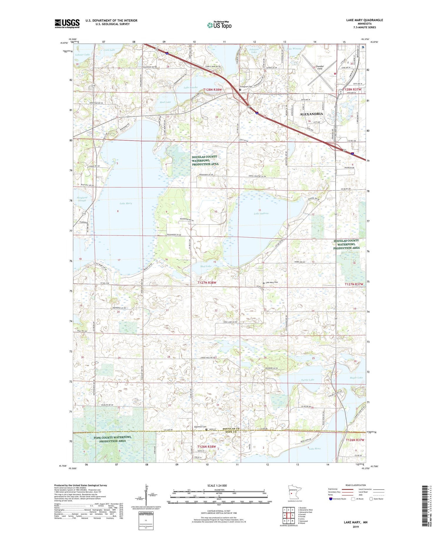
2019 topographic map quadrangle Lake Mary in the state of Minnesota. Scale: 1:24000. Based on the newly updated USGS 7.5' US Topo map series, this map is in the following counties: Douglas, Pope. The map contains contour data, water features, and other items you are used to seeing on USGS maps, but also has updated roads and other features. This is the next generation of topographic maps. Printed on high-quality waterproof paper with UV fade-resistant inks.
Quads adjacent to this one:
West: Farwell
Northwest: Brandon
North: Alexandria West
Northeast: Alexandria East
East: Forada
Southeast: Villard
South: Glenwood
Southwest: Lowry
Contains the following named places: Alexandria Clinic, Bohemian Cemetery, Broadway Medical Center, Chandler Field, Cork Lake, Dean Melton Park, Douglas County Hospital, Douglas County Hospital Heliport, Evangelical Covenant Church, Evergreen Cemetery, Fillmore Park, Johnson Lake, Lake Andrew, Lake Latoka, Lake Latoka East Bound Rest Area, Lake Mary, Lake Mary Cemetery, Lake Winona, Life Link III Air Alexandria Ambulance, Long Lake, Maple Lake School, Midway Mall, Minnesota Department of Natural Resources Forestry Division, Minnesota Watersheds Historical Marker, Mobile Park Estates, Mud Lake, Oak Grove School, Skogland Slough, Sunny Knoll School, Sunny Slope School, Surfside Resort and RV Park, Township of Lake Mary, Turtle Lake


