MyTopo
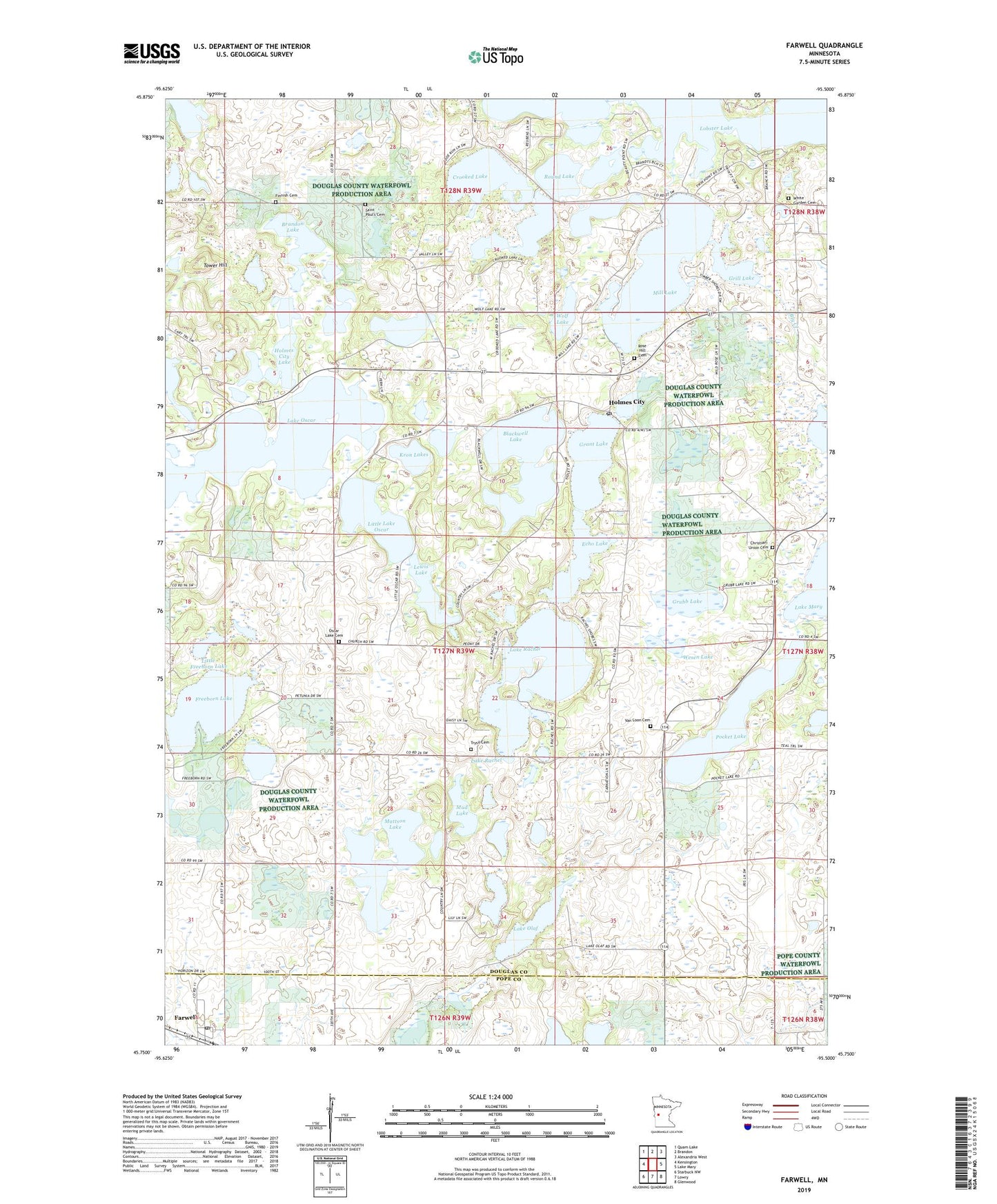
Farwell Minnesota US Topo Map
Couldn't load pickup availability
2022 topographic map quadrangle Farwell in the state of Minnesota. Scale: 1:24000. Based on the newly updated USGS 7.5' US Topo map series, this map is in the following counties: Douglas, Pope. The map contains contour data, water features, and other items you are used to seeing on USGS maps, but also has updated roads and other features. This is the next generation of topographic maps. Printed on high-quality waterproof paper with UV fade-resistant inks.
Quads adjacent to this one:
West: Kensington
Northwest: Quam Lake
North: Brandon
Northeast: Alexandria West
East: Lake Mary
Southeast: Glenwood
South: Lowry
Southwest: Starbuck NW
This map covers the same area as the classic USGS quad with code o45095g5.
Contains the following named places: Blackwell Lake, Bly Creek, Brandon Lake, Chermak State Wildlife Management Area, Christian Union Cemetery, City of Farwell, Crooked Lake, East Mill Nine Golf Course, Echo Lake, Farwell, Farwell Post Office, Finnish Cemetery, Finnish Church, Freeborn Lake, Grant Lake, Grill Lake, Grubb Lake, Holmes City, Holmes City Lake, Holmes City Post Office, Kron Lakes, Lake Olaf, Lake Oscar, Lake Rachel, Lewis Lake, Little Freeborn Lake, Little Lake Oscar, Mattson Lake, Mill Lake, Mud Lake, Oscar Lake Cemetery, Oscar Lake Church, Park Region School, Pioneer Trail State Wildlife Management Area, Pocket Lake, Rose Hill Cemetery, Round Lake, Saint Paul's Cemetery, Saint Pauls Church, Sun Valley Resort and Campground, Thompson Lake, Tower Hill, Township of Holmes City, Trysil Cemetery, Van Loon Cemetery, Wesen Lake, White Garden Cemetery, Wildridge Campgrounds, Wolf Lake, ZIP Code: 56327