
MyTopo
Lawrence Lake East Minnesota US Topo Map
Couldn't load pickup availability
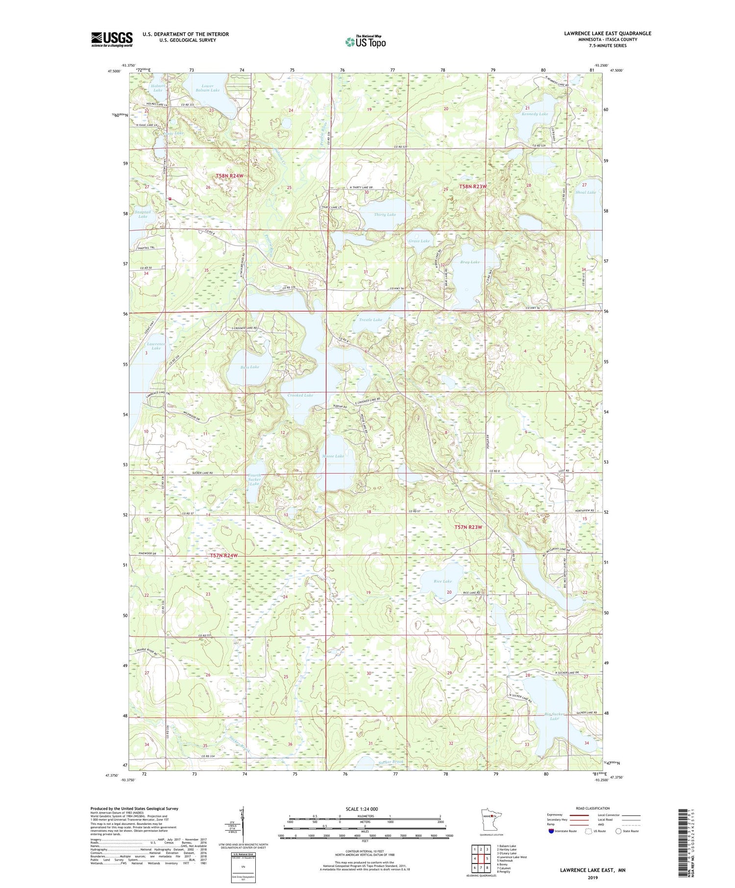
2019 topographic map quadrangle Lawrence Lake East in the state of Minnesota. Scale: 1:24000. Based on the newly updated USGS 7.5' US Topo map series, this map is in the following counties: Itasca. The map contains contour data, water features, and other items you are used to seeing on USGS maps, but also has updated roads and other features. This is the next generation of topographic maps. Printed on high-quality waterproof paper with UV fade-resistant inks.
Quads adjacent to this one:
West: Lawrence Lake West
Northwest: Balsam Lake
North: Hartley Lake
East: Nashwauk
Southeast: Pengilly
South: Calumet
Southwest: Bovey
Contains the following named places: Balsam Creek, Balsam Lake Chapel, Balsam Lake Mennonite Church, Balsam Lake School, Balsam Volunteer Fire Department, Bass Lake, Big McCarthy Lake, Big Sucker Lake, Bray Lake, Crooked Lake, Fourth Sucker Lake, Grass Lake, Holmes Lake, Isaac Lake, Kennedy Lake, Moose Lake, Rice Lake, Shoal Lake, Third Sucker Lake, Thirty Lake, Thirtyone Lake, Trestle Lake, ZIP Code: 55709


