MyTopo
Hartley Lake Minnesota US Topo Map
Couldn't load pickup availability
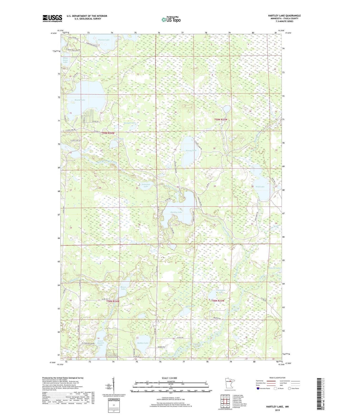
2022 topographic map quadrangle Hartley Lake in the state of Minnesota. Scale: 1:24000. Based on the newly updated USGS 7.5' US Topo map series, this map is in the following counties: Itasca. The map contains contour data, water features, and other items you are used to seeing on USGS maps, but also has updated roads and other features. This is the next generation of topographic maps. Printed on high-quality waterproof paper with UV fade-resistant inks.
Quads adjacent to this one:
West: Balsam Lake
Northwest: Anderson Lake
North: Horsehead Lake
Northeast: Sherry Lake
Southeast: Nashwauk
South: Lawrence Lake East
Southwest: Lawrence Lake West
This map covers the same area as the classic USGS quad with code o47093e3.
Contains the following named places: Christmas Lake, Day Brook, East River, Hartley Lake, Hartley Lake Dam, Jack Lake, Lower Balsam Lake, Moose Lake, Rahkos Lake, Round Lake, Scooty Lake, Someman Lake, Stowe Lake, Stumple Lake, Taconite Trail, Wasson Lake, West Fork Prairie River, Wolf Lake, Wolf Lake Dam