MyTopo
Little Prairie Lake Minnesota US Topo Map
Couldn't load pickup availability
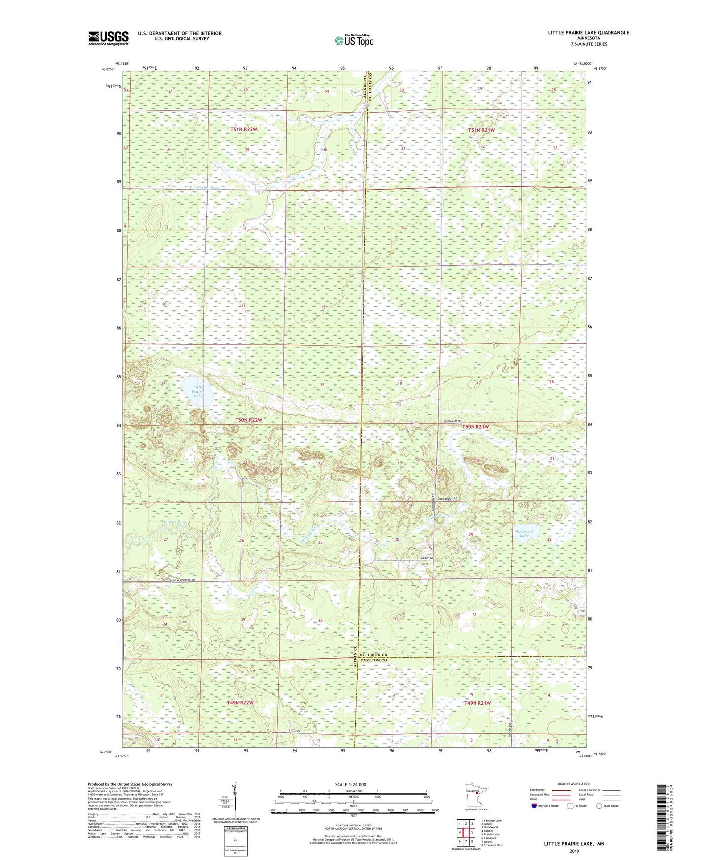
2019 topographic map quadrangle Little Prairie Lake in the state of Minnesota. Scale: 1:24000. Based on the newly updated USGS 7.5' US Topo map series, this map is in the following counties: Aitkin, St. Louis, Carlton. The map contains contour data, water features, and other items you are used to seeing on USGS maps, but also has updated roads and other features. This is the next generation of topographic maps. Printed on high-quality waterproof paper with UV fade-resistant inks.
Quads adjacent to this one:
West: Balsam
Northwest: Vanduse Lake
North: Island
Northeast: Floodwood
East: Prairie Lake
Southeast: Cromwell West
South: Wright
Southwest: Tamarack
Contains the following named places: Harrel Post Office, Little Prairie Lake, Roosevelt Lake