MyTopo
Balsam Minnesota US Topo Map
Couldn't load pickup availability
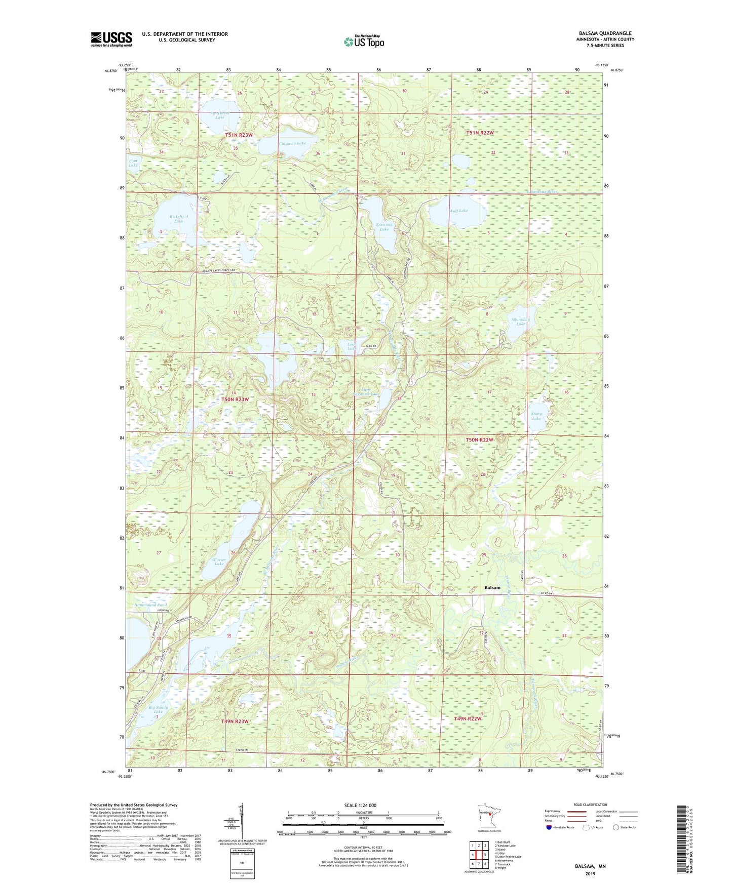
2022 topographic map quadrangle Balsam in the state of Minnesota. Scale: 1:24000. Based on the newly updated USGS 7.5' US Topo map series, this map is in the following counties: Aitkin. The map contains contour data, water features, and other items you are used to seeing on USGS maps, but also has updated roads and other features. This is the next generation of topographic maps. Printed on high-quality waterproof paper with UV fade-resistant inks.
Quads adjacent to this one:
West: Libby
Northwest: Ball Bluff
North: Vanduse Lake
Northeast: Island
East: Little Prairie Lake
Southeast: Wright
South: Tamarack
Southwest: Minnewawa
This map covers the same area as the classic USGS quad with code o46093g2.
Contains the following named places: Balsam, Chapel in the Pines, Cutaway Lake, Glacier Lake, Hammond Pond Dam, Hammound Pond, Little Savanna Lake, Loon Lake, Prairie River, Rat House Lake, Remote Lake, Sandy Lake Reservation, Savanna Lake, Savanna Portage State Park, Savanna State Forest, Shumway Lake, Stony Lake, Tamarack River, Township of Balsam, Wakefield Lake, West Savanna River, Wolf Lake