
MyTopo
Littlefork Minnesota US Topo Map
Couldn't load pickup availability
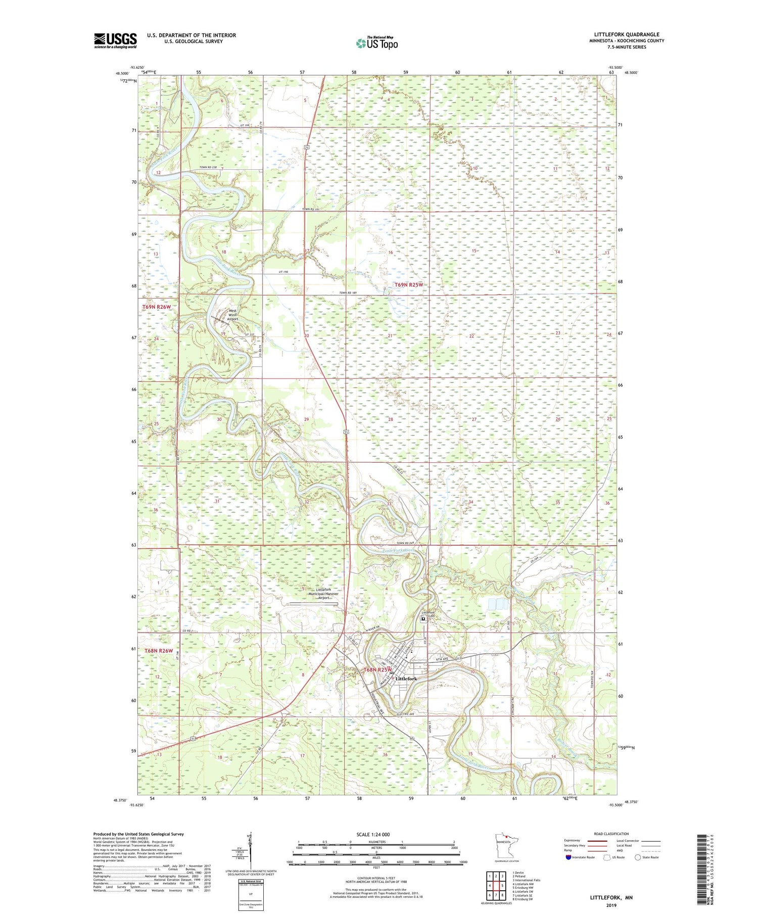
2019 topographic map quadrangle Littlefork in the state of Minnesota. Scale: 1:24000. Based on the newly updated USGS 7.5' US Topo map series, this map is in the following counties: Koochiching. The map contains contour data, water features, and other items you are used to seeing on USGS maps, but also has updated roads and other features. This is the next generation of topographic maps. Printed on high-quality waterproof paper with UV fade-resistant inks.
Quads adjacent to this one:
West: Littlefork NW
Northwest: Devlin
North: Pelland
Northeast: International Falls
East: Ericsburg NW
Southeast: Ericsburg SW
South: Littlefork SE
Southwest: Littlefork SW
Contains the following named places: Beaver Brook, City of Littlefork, Haye's Mobile Home Park, Little Fork Baptist Church, Little Fork Evangelical Church, Littlefork, Littlefork Ambulance Service, Littlefork Cemetery, Littlefork Fire Department, Littlefork Lutheran Church, Littlefork Medical Center, Littlefork Municipal Ambulance, Littlefork Municipal/Hanover Airport, Littlefork Police Department, Littlefork Post Office, Littlefork Station, Littlefork-Big Falls High School, Lofgren Memorial Park, Lofgren Memorial Park Campground, Merkling's Trailer Court, Northwood Chapel, Northwood Christian School, Saint Columban's Catholic Church, West Wind Airport


