MyTopo
Marion Minnesota US Topo Map
Couldn't load pickup availability
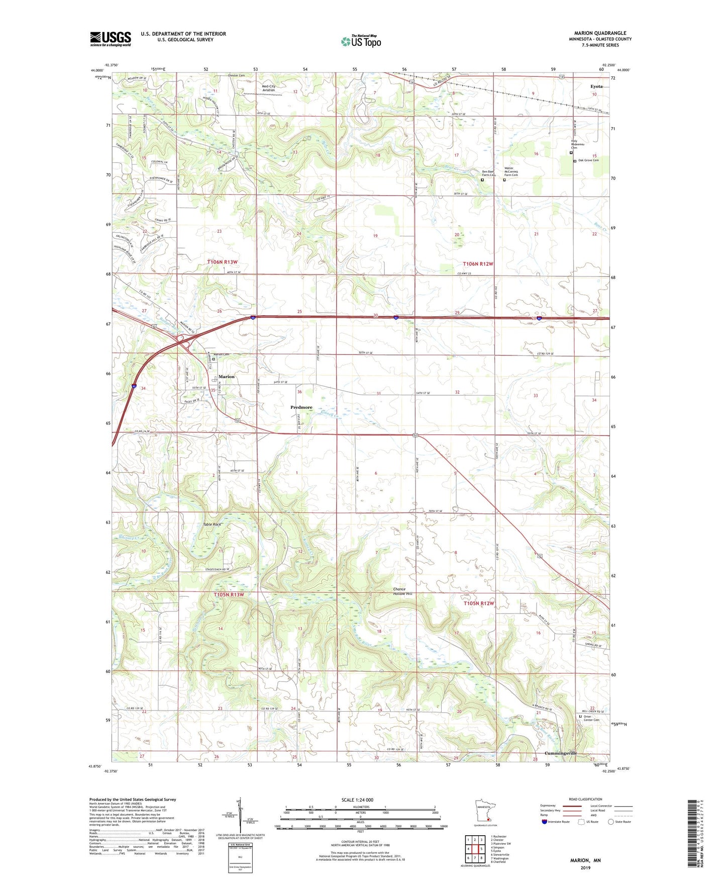
2019 topographic map quadrangle Marion in the state of Minnesota. Scale: 1:24000. Based on the newly updated USGS 7.5' US Topo map series, this map is in the following counties: Olmsted. The map contains contour data, water features, and other items you are used to seeing on USGS maps, but also has updated roads and other features. This is the next generation of topographic maps. Printed on high-quality waterproof paper with UV fade-resistant inks.
Quads adjacent to this one:
West: Simpson
Northwest: Rochester
North: Chester
Northeast: Plainview SW
East: Eyota
Southeast: Chatfield
South: Washington
Southwest: Stewartville
Contains the following named places: Ben Baer Farm Cemetery, Borst Family Farms, Chance Hollow Hill, Coffin's Cemetery, Evangeline Lutheran Church, Holy Redeemer Cemetery, Kinney Creek, Marion, Marion Cemetery, Marion Census Designated Place, Marion Church of Christ, Marion Post Office, Marion West Bound Rest Area, Med-City Aviation, Medical Pioneers of Minnesota Historical Marker, Oak Grove Cemetery, Orion Center Cemetery, Partridge Creek, Predmore, Predmore Post Office, Table Rock, Township of Eyota, Township of Marion, Township of Orion, Walter McConnell Farm Cemetery, Whitney Creek