MyTopo
Chatfield Minnesota US Topo Map
Couldn't load pickup availability
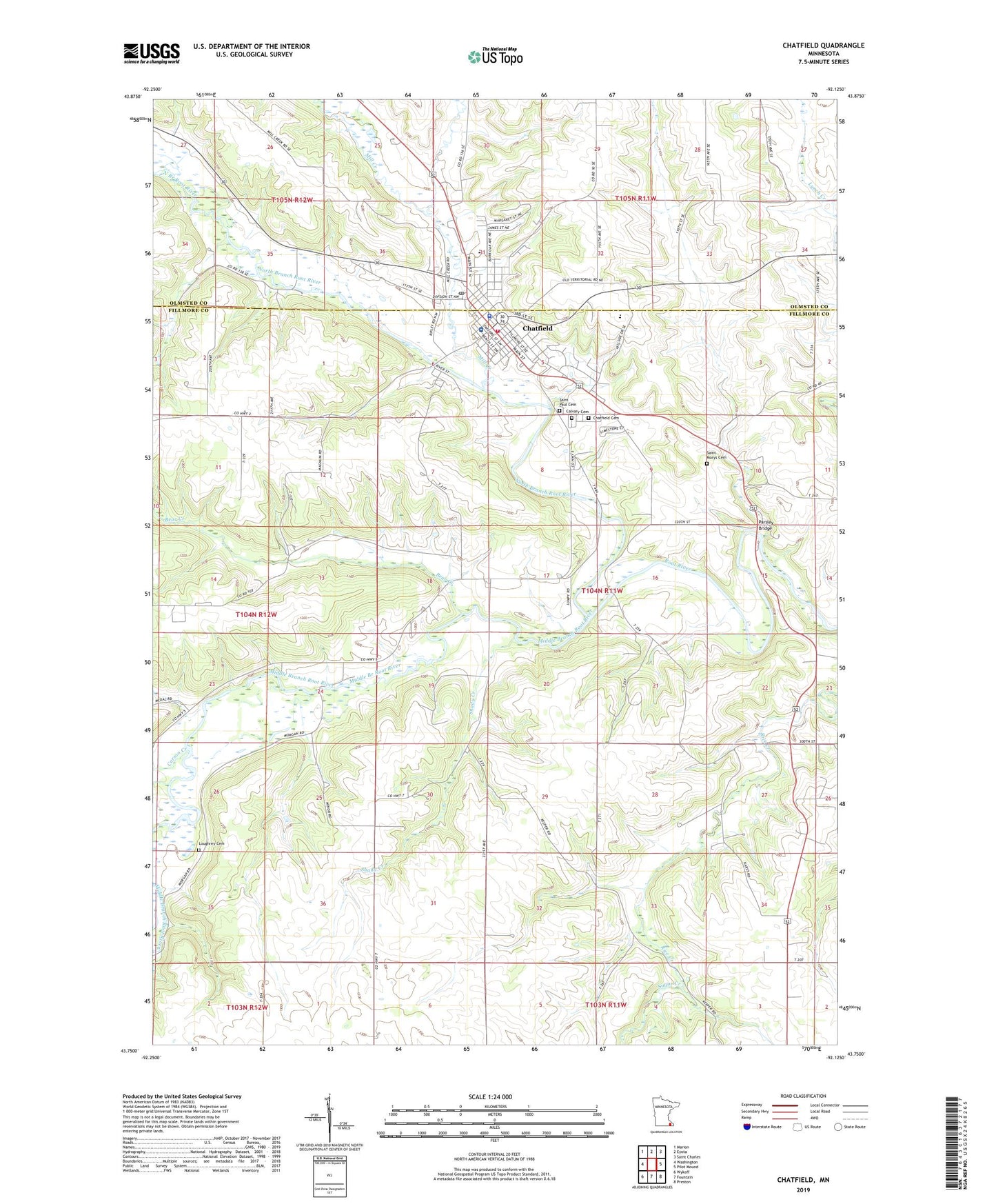
2022 topographic map quadrangle Chatfield in the state of Minnesota. Scale: 1:24000. Based on the newly updated USGS 7.5' US Topo map series, this map is in the following counties: Fillmore, Olmsted. The map contains contour data, water features, and other items you are used to seeing on USGS maps, but also has updated roads and other features. This is the next generation of topographic maps. Printed on high-quality waterproof paper with UV fade-resistant inks.
Quads adjacent to this one:
West: Washington
Northwest: Marion
North: Eyota
Northeast: Saint Charles
East: Pilot Mound
Southeast: Preston
South: Fountain
Southwest: Wykoff
This map covers the same area as the classic USGS quad with code o43092g2.
Contains the following named places: Bear Creek, Calvary Baptist Church, Calvary Cemetery, Carson Creek, Chatfield, Chatfield Ambulance Service, Chatfield Cemetery, Chatfield Fire Department, Chatfield Historical Marker, Chatfield Junior and Senior High School, Chatfield Lutheran Church, Chatfield Police Department, Chatfield Post Office, Chatfield Public Library, Chatfield United Methodist Church, Chosen Valley Care Center, Chosen Valley Elementary School, Chosen Valley Golf Course, City of Chatfield, Jordan Creek, Kohlmeyer Airport, Loughrey Cemetery, Middle Branch Root River, Mill Creek, North Branch Root River, Parsley Bridge, Parsley Bridge Rest Area, Pioneer Presbyterian Church, Ray Waller Dam, Ronald Gehling Dam, Saint Mary's Catholic Church, Saint Marys Cemetery, Saint Matthew's Episcopal Church, Saint Paul Cemetery, Saint Paul Lutheran Church, Shady Creek, Sugar Creek, Township of Chatfield, ZIP Code: 55923