MyTopo
Menahga Minnesota US Topo Map
Couldn't load pickup availability
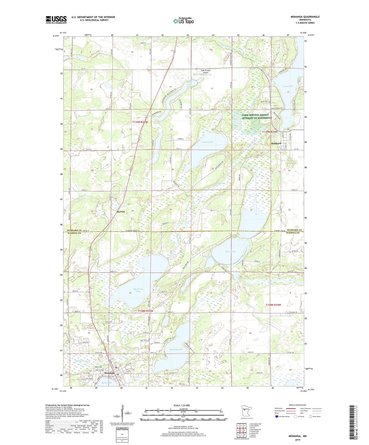
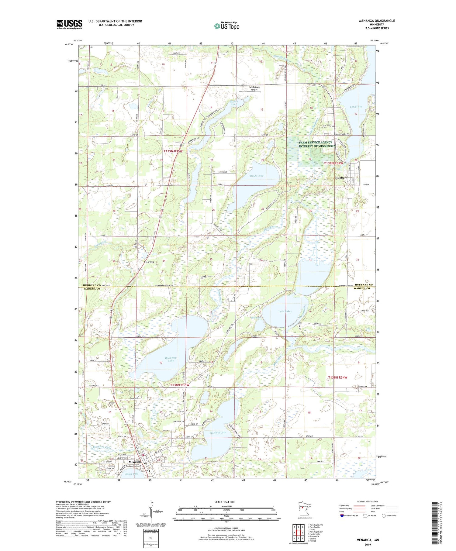
2019 topographic map quadrangle Menahga in the state of Minnesota. Scale: 1:24000. Based on the newly updated USGS 7.5' US Topo map series, this map is in the following counties: Hubbard, Wadena. The map contains contour data, water features, and other items you are used to seeing on USGS maps, but also has updated roads and other features. This is the next generation of topographic maps. Printed on high-quality waterproof paper with UV fade-resistant inks.
Quads adjacent to this one:
West: Park Rapids SW
Northwest: Park Rapids NW
North: Park Rapids
Northeast: Dorset
East: Huntersville
Southeast: Nimrod
South: Sebeka
Southwest: Sebeka NW
Contains the following named places: Ames Post Office, Bethany Lutheran Church, Bill Lake, Blueberry Lake, Blueberry River, Fair Havens Golf Course, Falk Private Airport, Fishhook River, Hinds Lake, Horton, Hubbard, Hubbard Census Designated Place, Hubbard Post Office, Latona Post Office, Long Lake, Long Lake Dam, Lord Lake, Menahga, Menahga Apostolic Lutheran Church, Menahga Fire Department, Menahga Police Department, Menahga Post Office, Moran Lake, Pine Haven Church, Stocking Creek, Stocking Lake, Straight River, Township of Blueberry, Township of Straight River, Twin Lakes, ZIP Code: 56464