MyTopo
Park Rapids NW Minnesota US Topo Map
Couldn't load pickup availability
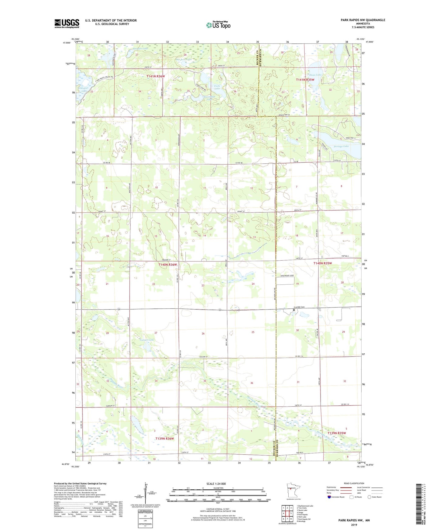
2022 topographic map quadrangle Park Rapids NW in the state of Minnesota. Scale: 1:24000. Based on the newly updated USGS 7.5' US Topo map series, this map is in the following counties: Becker, Hubbard. The map contains contour data, water features, and other items you are used to seeing on USGS maps, but also has updated roads and other features. This is the next generation of topographic maps. Printed on high-quality waterproof paper with UV fade-resistant inks.
Quads adjacent to this one:
West: Osage
Northwest: Big Basswood Lake
North: Two Inlets
Northeast: Skunk Lake
East: Park Rapids
Southeast: Menahga
South: Park Rapids SW
Southwest: Wolf Lake
This map covers the same area as the classic USGS quad with code o46095h2.
Contains the following named places: Beden Lake, Crandall Cemetery, Fools Lake, Horseshoe Lake, Knights Lake, One Acre Lake, Sloan Lake, Township of Osage, Valines Lake, Wapsi Lake