
MyTopo
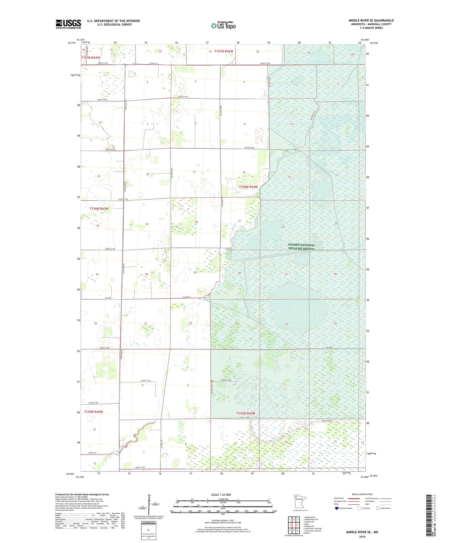
Middle River SE Minnesota US Topo Map
Couldn't load pickup availability
2019 topographic map quadrangle Middle River SE in the state of Minnesota. Scale: 1:24000. Based on the newly updated USGS 7.5' US Topo map series, this map is in the following counties: Marshall. The map contains contour data, water features, and other items you are used to seeing on USGS maps, but also has updated roads and other features. This is the next generation of topographic maps. Printed on high-quality waterproof paper with UV fade-resistant inks.
Quads adjacent to this one:
West: Holt
Northwest: Middle River
North: Middle River NE
Northeast: Gatzke NW
East: Gatzke SW
Southeast: Mavie
South: Thief River Falls NE
Southwest: Thief River Falls NW
Contains the following named places: Agassiz Pool, Green Stump Pool, Lansing Parker Reservoir, Madsen Pool, Madsen Reservoir, Mud Lake, Mud River, Northwest Pool, Pool Eleven Dam, Pool Ten Dam, Pool Three Dam, Pool Twentyseven Dam, Sorum Post Office, Township of East Valley


