MyTopo
Nelson Slough Minnesota US Topo Map
Couldn't load pickup availability
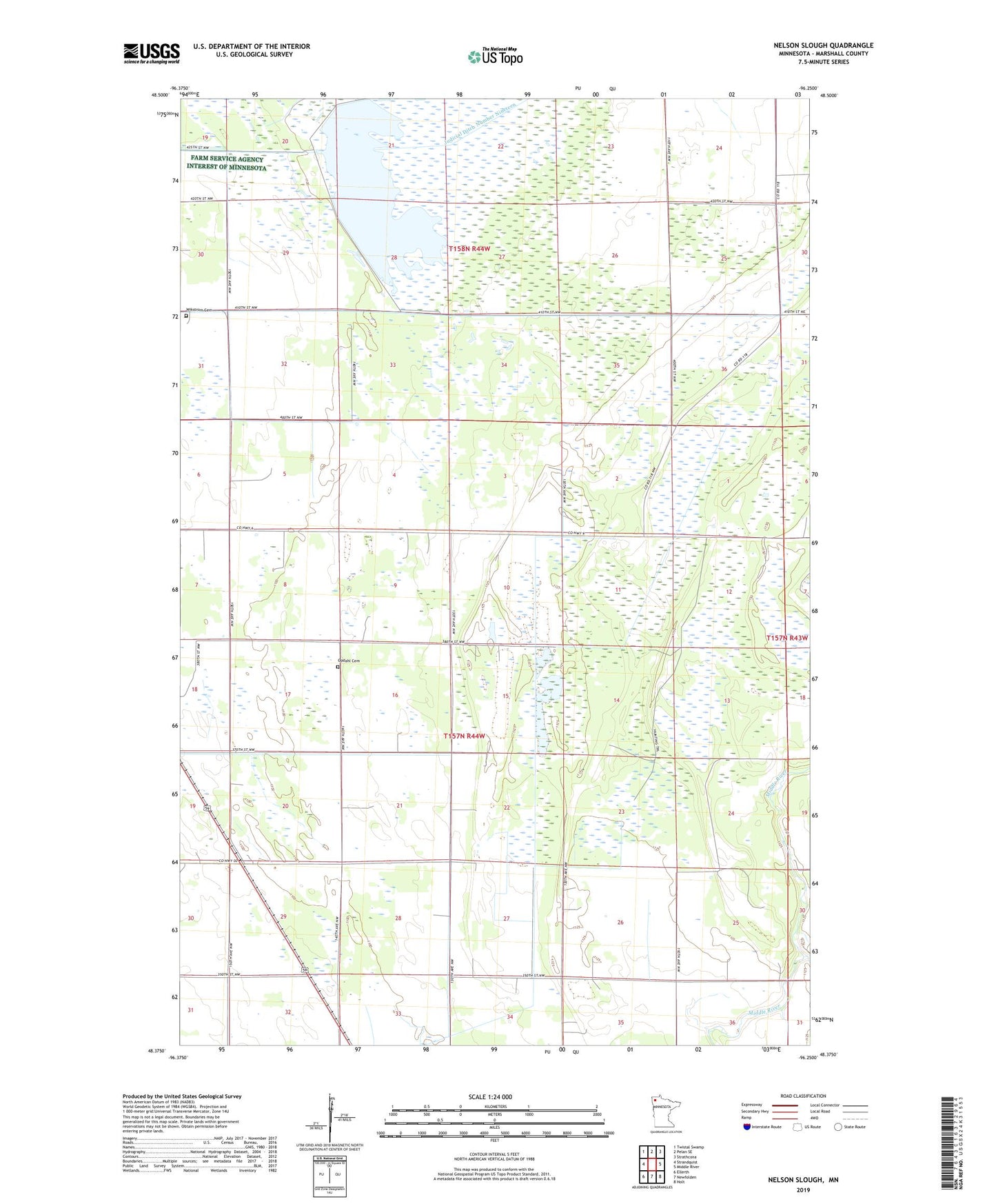
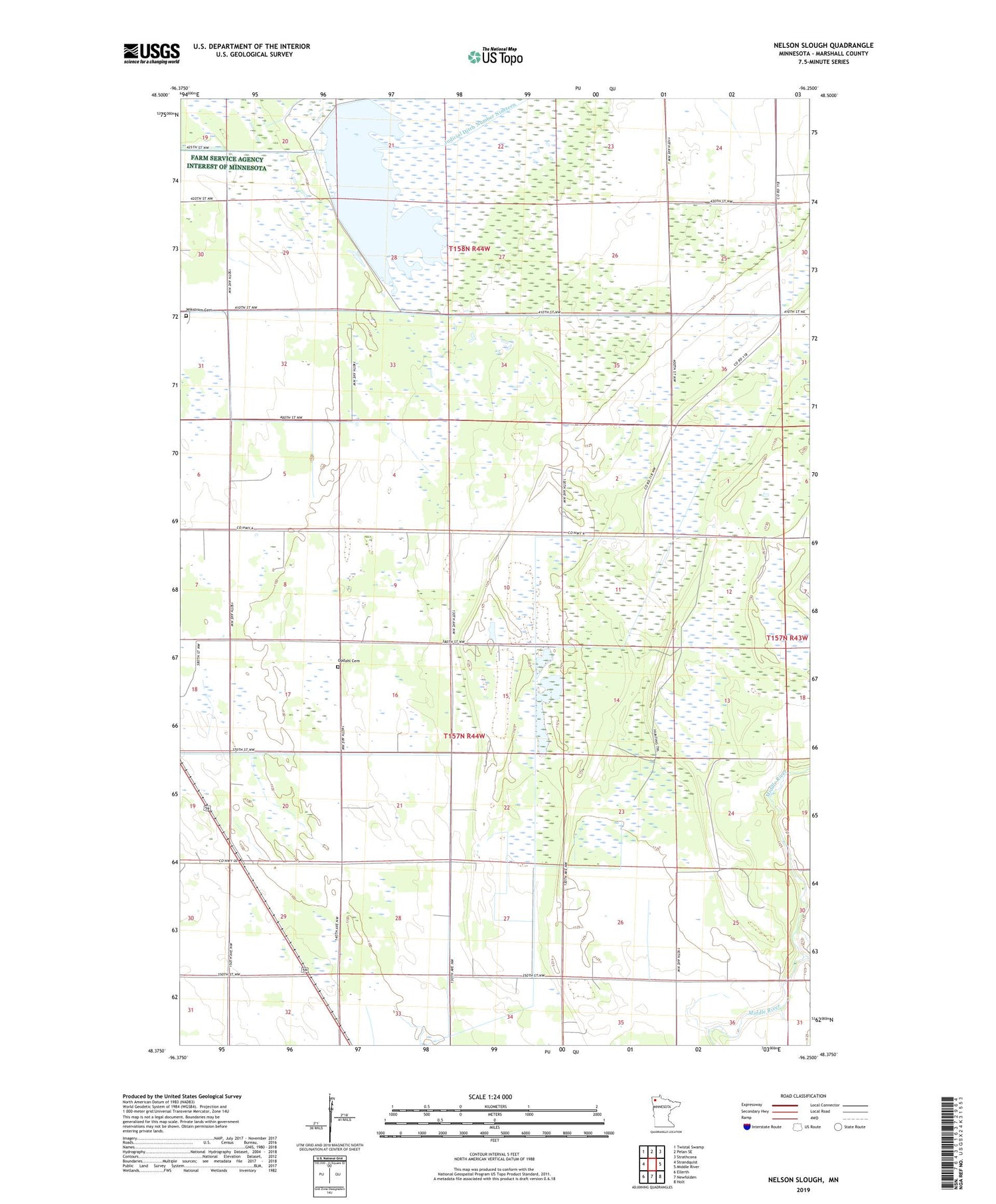
2019 topographic map quadrangle Nelson Slough in the state of Minnesota. Scale: 1:24000. Based on the newly updated USGS 7.5' US Topo map series, this map is in the following counties: Marshall. The map contains contour data, water features, and other items you are used to seeing on USGS maps, but also has updated roads and other features. This is the next generation of topographic maps. Printed on high-quality waterproof paper with UV fade-resistant inks.
Quads adjacent to this one:
West: Strandquist
Northwest: Twistal Swamp
North: Pelan SE
Northeast: Strathcona
East: Middle River
Southeast: Holt
South: Newfolden
Southwest: Ellerth
Contains the following named places: East Park State Wildlife Management Area, East Park Wildlife Management Area Reservoir, East Park Wildlife Management Pond Dam, Jevne Post Office, Judicial Ditch Number Twentyone, Loveid Post Office, Opdahl Cemetery, Opdahl Post Office, Township of New Maine, Wikstrom Cemetery